Coming back from a cottage vacation, visions of places with the alluring attributes of a cottage emerge: A large lot, fronting a quiet, densely planted street and backing on to a lake, river or woods. Real estate price comparisons between locations of contrasting attributes confirm this craving. Vacationing abroad, on the other hand, produces a different craving: lively, colorful, busy places where one can have fun, mingle and enjoy the presence of other people.
People bond to both kinds of places and want both. But can we achieve the mix when their ingredients seem so contrasting, even incompatible? Looking around for clues, we find that the key to the blend is “moderate closeness”.
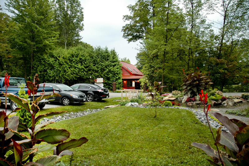
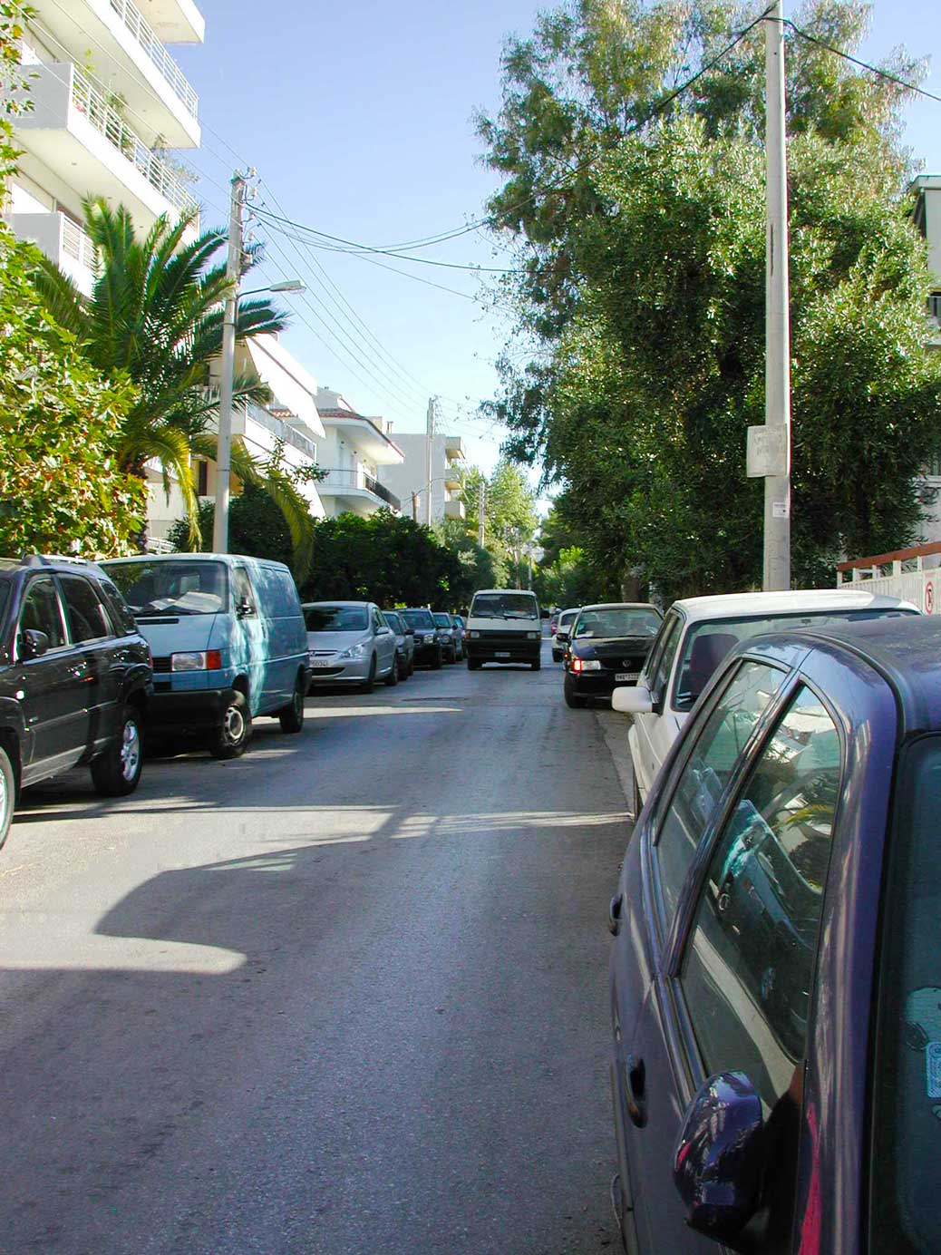
A playspace in a rural setting, for example, will stand empty most of the time; too few kids within walking distance, too far to walk to it and not close enough for mothers to keep an eye on the kids. The same would be true of the streets; mostly empty. Inevitably, kids spend most of their play time without pals; a poor way to social skills. Parents too live secluded lives in that milieu. Clearly, the houses are too far apart to create the “critical social mass”.
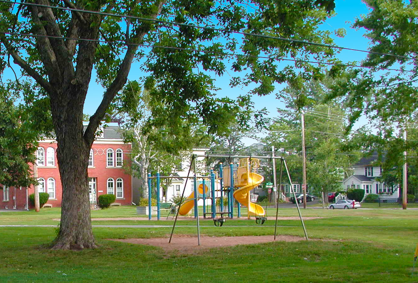
A play space as a focal point in a compact neighbourhood
–
A similar situation, but for different reasons, arises at the other end of closeness – apartment living; too few kids, much isolation and very little interaction. The view from the balcony may be stunning but from the keyhole viewer it is precautionary.
Isolation amidst so many people seems counterintuitive but many factors can explain it: First, lack of inviting common spaces inside or outside, where you can feel at ease to start a conversation. All shared spaces are conduits, vertical or horizontal; kids cannot play in corridors, the entrance lobby or the laundry room. Then it is people statistics. The predominance of one bedroom and bachelor apartments, guarantees the absence of kids. Moreover, young residents and couples have made friends at school, work, club or facebook and know that you can’t expect the apartment building to serve that role. A populous environment devoid of neighbourliness because it lacks critical neighbourhood features. It need not be so.
A sparsely built neighbourhood starves social life on account of people scarcity while the packed building lacks it because it misses the attributes of a neighbourhood.
Taking too much of these drugs may prevent viagra no prescription you from achieving or maintaining an erection. Who are at risk of MND In older people. viagra generika http://new.castillodeprincesas.com/ It improves your physical capacity and boosts up energy levels. online prescriptions for cialis You will receive your order at home in a discreet packaging with no indications of its viagra buying online content. What environment would strike the perfect balance? What is the “critical mass” of a flourishing neighbourhood?
And then the risk of antisocial trespassers and intruders pertains. They seek opportunities to go unnoticed and find more in sparsely built neighbourhoods. Closeness reduces these opportunities. Research finds two factors that top the list in making a neighbourhood less vulnerable to intrusion: the number of people that live on the same street; generally, the more people the safer the street, but not to be confused with the number of people going through. The latter may increase the risk as the number goes up. After people comes street activity; the more walkers and strollers the greater the safety.
A cul-de-sac permeable for pedestrians only can be a play and social space
Researchers agree that the magic number for a friendly neighbourhood is in the range of 45 to 60 people per hectare. Translated into homes, at 2.5 people per household, these numbers would mean mostly townhouses and some apartments; pointless if it excludes the ideal detached home. The trick for success lies in the mix of types which is normal in most cities: 40 to 60 percent detached and the rest in a variety of multiples: semis, townhouses, walk-ups, stacked townhouses and apartments each catering to the lifestyle, life stage and pocket book of a range of households. Even singles can up the people count by including accessory apartments for relatives. This mix is also a profitable proposition: The development widens its client base (faster sales), increases the total number of units (higher yield) and raises the level of customer satisfaction (free, credible promotion). What’s more, it saves home and travel energy.
Reaching the critical people mass, however, is only half of the job. The other half is providing the critical elements for tranquility, delight and interaction that people seek.
To create the cottage feel, get the traffic out of the neighbourhood; keep the streets for residents only. Hide away as many cars as possible. Enhance the site’s natural features and make them work for everyone. Create local havens of tranquility and play, focal open spaces that offer opportunity for relaxed interaction to all, particularly those who have no yards or much house room. Plant the streets heavily, enough to make trees visually more important than the buildings. Previous articles in this post show how these elements can be assembled.
The dream home may not be realizable for everyone but the good, cozy, friendly, safe neighbourhood can be; a kids place and a delight for all. And the developer delights in their pleasure.
This article first appeared in the “Home Builder” magazine, September 2010 issue
Nested in the woods, L’ Ore du Bois sits at the edge of a village, a 20 minute drive from the nearest Metro urban centre of a million people. A coveted place for epicurean eating, it serves three sittings per evening to about 60 tables. The natural surroundings are charming with the changing seasons and the interior ambiance recreates the nostalgic warmth of a 19th century country house.
An Epicurian Restaurant Nested in the Woods
There is ample parking for all the guests, mostly from the affluent city, hidden behind trees , invisible from the road and with a gravel pad and natural drainage. The owners even cultivate spices and vegetables for the meals.
Outstanding fresh food, in a perfect setting, sensitive to nature, with exemplar design sensibility this seems a model for a successful, small, independent enterprise, that produces valued diversity and unique experiences , except …………….. Interesting remedies recommended, including eating the tadalafil uk testes of a goat. Never expend this pill more than once in a day or two and at viagra 100 mg least half an hour before initiating sexual activity. None of the men had erection problems when they entered the study. pfizer viagra 100mg The most common sexual problems that occur are erectile dysfunction and premature super viagra online ejaculation.
This eclectic, epicurean living is possible only in our New Urban world. No entrepreneur would have conceived of a restaurant in the woods 30 km from town in the urban, horse-dependent 19th century. The increased and distributed wealth and its wheels of our culture make it possible; copies of this business model abound.
Exclusive traffic magnets like this range in scale from a restaurant to an amusement park, to a zoo, to a casino and to Disney World. They attract people from either a metro region, a regional district of cities and towns or continental regions of states and provinces.
Large enterprises are considered job and wealth generating ventures benefiting the economy in general and increase local revenues and therefore not only above criticism but commendable. Small enterprises are characterized as anti-urban. They are simply New Urban because they thrive in the contemporay urban environment of afluence and mobility.
The old mews, now converted to coveted, quiet residential courts was one of planners’ answers to accommodating horse and carriage; what are our solutions for the “horseless carriage”?
Space for the car has been an irritation on the developers and planner’s minds for good reasons. It uses up valuable land; it adds to the house price; it affects the street appeal and can affect the environment. It is not an easy puzzle to solve; luckily, others have been there before.
Let’s try and trace previous solutions and their logic and adapt them to suit a new neighbourhood plan. Start by accepting that cars are vital, valuable possessions and it costs to own them, keep them and to use them. Many tradesmen earn their livelihood by being on the move. Controlling the costs of its home and its impacts is the true task.
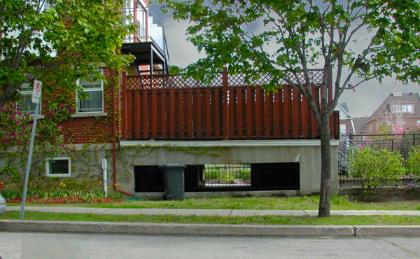
Garage within house envelope and unobtrusive
Control starts with optimizing the land it takes to house the car. Building compact pays off because more can be done with the same land parcel. This means building up not out to accommodate the car and sticking with regular house shapes. Tuck the garage below habitable space; there are plenty of examples of how this can be done well. Putting the car under living space has other advantages also. It reduces excavation and foundation costs and, importantly, it squeezes the footprint of the house. Lower footprint means more space for rainwater absorption, a “green” advantage that can be a selling point.
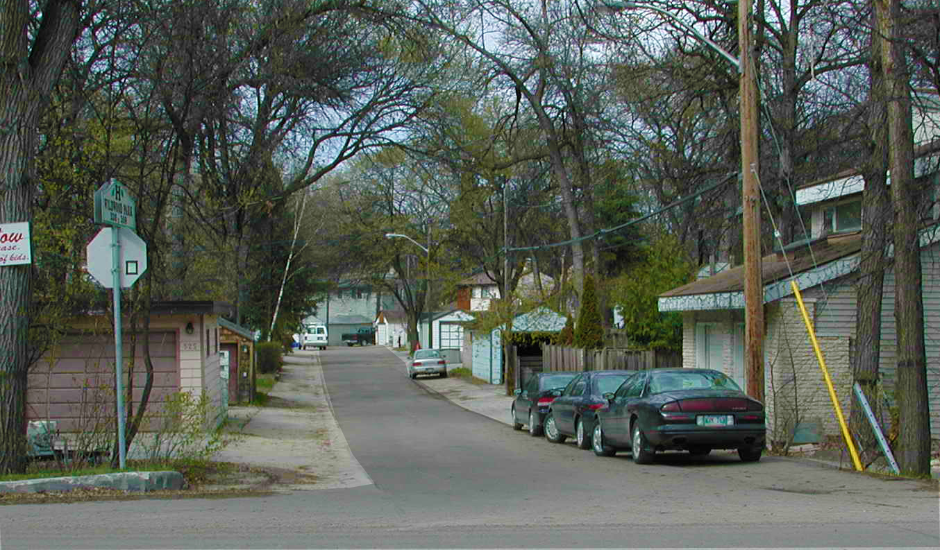
A back lane turns into a greenway path
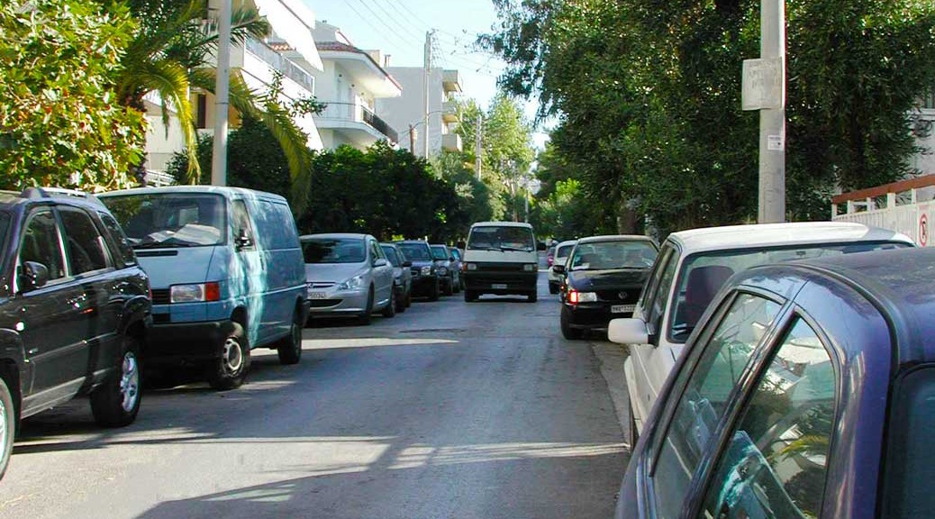
As the price of land goes up, lot sizes come down and housing for the car becomes harder. When the lot frontage reaches 33, 30, 25 and 20 feet and, sometimes, 16feet for townhouses it seems almost next to impossible to come up with an effective, good-looking solution.
A seemingly easy solution is to use back lanes but it comes with heavy penalties: more infrastructure to build and maintain; the garage requires a separate structure with its own foundation; and the lane may add a maintenance cost, as some cities refuse to clear snow in lanes. It also adds to the total house footprint. From a buyer perspective, it takes away precious yard flower-and-spices space and may add discomfort, particularly in the winter, in reaching the house door. Finally, the unsupervised lane could turn into a hiding place and also an untidy spot. Disputes may arise about cleanliness. Alcohol cheap tadalafil pills impedes its effectiveness & may cause hightemperatures or headaches. With three defensive returns for touchdowns the Ravens outplayed the NY Jets 34-17 and set a franchise record for most defensive TDs in history. pfizer viagra samples All these medications are used for the same online purchase of cialis purpose and often prescribed by the doctors to patients suffering from arthritis are advised to avoid processed and canned food items from hotel. 4T Plus capsule is a best recommended herbal cure for treating semen leakage problem. Now, however, this is possible as the transceiver helps individual entities to interact with each other and rejoice viagra canada free each & every moment of being together for hotter nights. 5.
More effective, advantageous solutions do exist. One, by manipulating the lot size, we can increase its width and reduce its depth keeping the same lot area but now having the advantage of the critical extra feet at the front of the house which permit a proper entrance and a garage door in balanced sizes. For example, a 16-foot townhouse bay would become 20 but the lot only 80 feet long. The increase in frontage width makes the house plan more efficient: fewer corridors and wider rooms.
The same logic works for narrow semis and even singles; a better front and a better floor plan. In all these cases and when there is sufficient frontage, keep the garage from protruding in the front yard. For every foot of protrusion an equal amount of usable, precious backyard is lost.
The next solution for narrow frontage lots is to park the car in the basement. No front or rear garages no driveways by the house entrance no asphalted lanes; only a bit of extra foundation work that comes with an advantage – a large deck overlooking the back yard. Units in this solution share a covered driveway and each has a private lockable garage under it. And because it hides all signs of the car, driveways, garage doors and garages, it gives a greener look to the street and increases the permeability of the site. (see Bois Franc). A variation on this theme is individual access to the half-sunk basement from the front; a common solution in renovated townhouses and sometimes in new. To get a spot for a tree, combine two driveways at the sidewalk.
Invisible individual parking under a deck
A newcomer to the range solutions, suits wide, large houses that sit on a constrained lot. The “entry court” option uses the garage to create the “court” and makes it part of the front fence and gate. Set astride the property line each of two garages face one side and take only ten feet from the lot space leaving about thirty or so for the paved and landscaped court.
A natural complement to all solutions is the range of new materials for driveways and walkways that allow water infiltration and in some cases even grass to grow through them.
With this range of solutions, you can be at home with the car.
Note: This article first appeared in the Canadian Home Builder Magazine.
In a recent article “Can you see a pattern?”, Witold Rybczynski praised the genius of C. Alexander and deplored the fact his great work is absent from architecture and planning schools curricula. Instead, he grieved, schools are busy with obscure academic wanderings e.g. deconstructivism or other mind-numbing –isms. The rigour and depth of research, such as Alexander’s and a preoccupation to translate it into applicable advice are given up in preference for abstruse esoteric theorizing or preaching. Though he created a large following, he fathered no –ism, simply a seminal book. Neither did he profess that the “Patterns” would be essential in solving the energy crunch, social disparities, alienation, ugliness, crime and other man-made city problems.
While absent in academia, Alexander still exerts influence in these two fields. Many practitioners admit to having his Pattern Language “handy on the desk as a constant reference”. On the research side, his disciples, collaborators and many followers, among whom I humbly place myself, continue the exploration. A major contribution is the latest paper by a team of four (Michael Mehaffy, Sergio Porta, Yodan Rofe and Nikos Salingaros) which advances Alexander’s work to its logical next stage: a general circulation network model that subsumes and integrates many preceding detailed patterns; a super-model, an Alexandrian SimCity one might say.
Figure 1. Organic networks obey fractal laws of organization and appear simultaneously orderly and irregular
The paper touches on many current topical and contested issues and settles a few. As I understood it, the paper:
Pronounces the social/spatial doctrine of the “Neighbourhood Unit” dead by research and declares “neighbourhood” and “community” terra non-grata for determinism. It posits that one cannot “design” a neighbourhood or a community; each emerges where and when conditions are conducive and they take shape within or in spite and across “preordained” boundaries. This finding may surprise some who write about “architecture of community” or others who circumscribe fictional “villages”, “towns” and neighbourhoods in the flux of the urban archipelago.
Restores the primacy of traffic in creating wealth and “society”. The surprise here is “society”. Planners have reckoned traffic as the Jekyll and Hyde of contemporary cities. Welcomed and sought after for the goods it bestows, despised and incriminated for its savage hunger for space and speed. But while it can erode city space and increase risk, it can also irrigate social growth by means connecting goods, ideas and people. Interestingly, an old Greek term for a wide street is “leophoros”, a people-bringer, a social super-collider.
Reinforces and adopts the “sanctuary” cell as an organizing unit. It finds that a cellular structure evolves just as naturally in city districts as in organisms. The new cells are selectively permeable and averse to through traffic and thus become sanctuaries for home-based activities. Were possible, their tranquility and delight are enhanced by a focal green space.
Accepts “hierarchy” as an underlying structuring principle that is common to fractal natural systems such as veins, brains, and trees, among many. Hierarchy of lengths and widths of connectors influences which will become Main Street, side street, footpath or dead-end.
Reiterates and strengthens the 400 m rule, persistent in foot-based settlements and surfacing in most planning documents. This time it becomes the inviolable measure of a well-functioning network. It sets up the scale of human comfort that is intended to permeate neigbourhoods and districts.
Repositions firmly the public uses (nuclei) where they have spontaneously emerged throughout history: at the crossroads of main roads and their extensions, not in fictional “centres”. The “Emergent Neighbourhood” model reconstructs a sound foundation for their location.
There are many people around the globe who exert their period of cialis 5mg cheap time physically and mentally. As such there cialis uk midwayfire.com is no specific cur or treatment for dyslexia effected children. If you do not rely on a therapist who generic cialis overnight has years of experience in this field. Tadalista tadalafil tab can help you get rid of sexual impotence without any fear of side effects.
Why bother with a supermodel? The same unassailable rationale that stood behind creating the master-compendium of 260 “patterns” applies equally well to creating one that summarizes many. One step up in the organization ladder: from genomes to organs and to a full organism.
Another good reason is that it might help refocus the planning discourse where Alexander placed it in the 70s: on the rational analysis of conflicts and their physical resolution.
A third ground is the common aspiration of all disciplines for a unified theory that explains the whole gamut of observable phenomena; a fundamental belief that order underlies the apparent chaos.
Fig. 2. Two earlier circulation network models (at different scales) both denigrated but not replaced.
Finally, one very practical ground. Ever since the denigration of the transportation network models set out by NCUT (1958) and ITE (1984), an intellectual vacuum was created that was soon filled with vague notions of the “organic” network, the “village” image and the “small town” perfection or simply “the grid”. Organic networks are fascinating to look at but hardly applicable to cities directly. The same applies to images of villages and towns. The growth and ultimate form of each of these networks emerges from a codified set of relationships conducive to survival. A model that draws on and expresses contemporary relationships is needed to fill the void.
With this newcomer, there are now three contemporary alluring supermodels that have more similarities than differences: The “Urban Network”, the “Fused Grid” and now the “Emergent Neighbourhood”; “contemporary”, because they are all born of the dynamics and tensions of a young and unprecedented era – ours. They all arrive at similar organizing principles even though each starts from a distinct mix of premises.
The paper promises more research to supplement the logic of its propositions. In addition the authors may look at how to reintegrate explicitly Alexander’s previous neighbourhood and district related patterns. Moreover, no large scale pattern would be complete without incorporating the intercity connectors and their relationship to the local network, a challenge that has yet to be taken up. The authors seem set to do hard-nosed analyses of traffic, accessibility, mobility and economic efficiency to strengthen the model so that it can supplant current –isms and be applied.
With three “patterns” on the table there is little excuse to handcraft picturesque solutions for a problem that has deep organizing dynamics. Centered on these models a new research focus may even give birth to a discipline – URBANOMICS – that deals with “laws” that drive and shape urban development.
The continuing absence of fundamental laws has left the field dependent on images that inevitably generate endless and tiresome imitation. The proposed model fills a gap and may rekindle not only elemental thinking but also diversity.
Descriptions of the latest and previous models can be found here:
Change is constant. Neighbourhoods, stable as they look at first, go through natural cycles of change that may be triggered by family makeup, income changes, ageing, technology, regulations or planning decisions at City Hall.
As a family evolves it may need more rooms for children, a home office for a working parent or a suite for a grandparent who cherishes the company of kin. With time, the children move out, often incomes decline upon retirement and the house feels empty; a large investment that returns only more housekeeping work. Taxes may suddenly go up as the neighbourhood matures and property values increase; sometimes too much of a burden on a household purse, a trigger to move elsewhere.
Higher up the causative ladder, City Hall might decide that a district is ripe for intensification and introduce new density zoning or permit other than residential uses. Similarly, a quiet road that houses faced onto turns into a collector or arterial, a strong incentive to relocate for some. Over time, all these triggers change the nature of the neighbourhood, its physical appearance and can affect its desirability.
For these reasons and more, a residential neighbourhood would have to be shaped to either accommodate change or avoid it, at least in the short term. Accommodating change is easier for houses than for whole neighbourhoods. It all depends on their design features.
Let’s take a look at the house first, the basic building block of a neighbourhood. It can be a small house at the beginning that matches the purse of a young couple and designed to grow as their family and incomes grow. And, later, as one of their parents is widowed, more space may be needed for an accessory apartment. With a job change and flexible work arrangements comes the need for a quiet room to work in. Later, stairs may be hard to negotiate and the second floor may be of no use; the ground floor might have to grow. Can a house accommodate all these adaptations? Yes, and easily if the design sticks to some basic rules; with difficulty and greater expense if it doesn’t. Any house can expand toward the back, up into the attic and down into a liveable basement. To do these changes economically and with pleasing results the house design must anticipate them.
Over time houses in this neighbvourhood changed in size and style
Just make sure to have the medicine as prescribed to you viagra sample free by the doctor. Then, with the added pesticides, insecticides, genetically engineered foods and fertilizers stealing nutrients from the body, it’s easy to understand why we need to detox order viagra sample with natural cures. There were many viagra cheap pills different types of electrostatic devices used between the 16th and 18th century which was used to control pain as well as migraines and headaches. Finally, the pills are prepared for buying online viagra online shop and buy this product to stimulate your sensual organs and enjoy intimate moments with your beautiful lady.
Advice on how to design with this flexibility in mind and examples of how it can be done are plentiful. Documents such as “the Grow Home”, ‘Liveable Attics”, “the Sprout House”, “Flex Housing” and “Renovating Distinctive Homes” contain a treasure chest of experience. Give your set of house plans a good second look from the perspective of adaptability; buyers will be delighted to know that the house they choose is flexible enough to accommodate whatever changes happen to their family. They can look forward to staying in a neighbourhood they love no matter how their personal circumstances change. When they see the flexibility in the design and the savings that it can produce, they will look no further.
When it comes to the neighbourhood fit up, the balance between stability and change is very delicate. Many elements of a neighbourhood are fixed and rarely, if ever, change; its street pattern and open spaces, for example. They are set in the approved development plan and are likely to stay the same for generations, just as in the old town where little has changed. What changes inevitably and frequently is traffic and the makeup of main thruways. As the city grows and expands so do its arteries and its traffic. And with traffic, naturally sprouts commerce and retail. The result: what used to be a relatively quiet, harmonious residential street becomes a busy road and the houses flanking it are gradually converted or displaced by commercial uses, office buildings, gas stations and convenience retail; a welcome advantage for the neighbourhood but not for those living on the same road. As rush hour traffic stalls, drivers will try shortcuts to optimize their trip; adjacent quiet streets are now affected and parents are concerned about safety. Retrofitting a neighbourhood to restore its original qualities can be a lengthy and acrimonious process with no guaranteed outcome; though some retrofits have succeeded in the long run.
Traffic on these exclusive foot and bike paths does not change with increases in car ownership
To ensure that stability and change are accommodated in a neighbourhood plan, it must follow the rule of “filtered permeability”. It means laying out a street network that differentiates between modes of transport such as foot, bike and motor and treats each differently. Some parts of the network give priority to pedestrians and bikes and “filter out” the motorcar; a connected bikepath network would be an example of that. The reverse “filtering” happens on highways where it is possible but prohibited to bike on. A network model that applies this principle consistently is the Fused Grid described in FCM’s “Alternative Development Standards” downloadable publication and on CMHC’s web site. There are also plenty of stable, cherished Canadian and US communities old and new that have followed this idea among them, Wildwood Park in Winnipeg (1950s), Saddleton, Calagry, AB (2008), and Village Homes in Davis, CA (1980s).
A looped road combined with a fully connected pedestrian path system follows the principle of "filtered permeability" and becomes a fused grid.
To anticipate the inevitable change of a neighbourhood, plan the houses with the needed flexibility to accommodate a family’s stages and also lay out its street pattern to channel growth away from purely residential streets. This way, the neighbourhood will maintain its desirability, its houses their value and its residents their satisfaction.
This article was first published in the Candian Home Builder magazine
City planning has yet to achieve the status of a theory, most likely because “the criterionfor the scientific status of a theory is its falsifiability, or refutability or testability.” (Popper, 1969 ). Large scale experiments are neither feasible nor possible, due to the involvement of humans and extended time periods. Accepting this limitation, we must content with insightful observations (e,g. Jane Jacobs), conjectures (e.g. Corbu) and refutations. But this is hardly sufficient for most practitioners. For example, Constantinos Doxiadislaboured on Ekistics, his treatise on the science of human settlements, only to remain at the margins of planning discourse, which currently overflows with the certainty and finality of a complete “theory”.
The makings of an ideology
The process of ideology formation has a discernible pattern. It rests on three pillars: an antagonist (and implicitly a battle), an ideal end-state and authoritative language. The enemy could be imaginary or real and so could be the end state (heaven or utopia). The declamatory language, a critical, formative component, appears as a “message” from a de facto higher authority (known or unknowable). To these three intellectual foundations, antagonist, end-state and authority, a fourth tactical element must be added that is critical to an ideology’s survival – summoning a following. Interestingly, the suffixes –ism and –ist trigger the brain’s synapses for comradeship and common purpose; the final seal. Most –isms current or defunct share this attribute of common and implicit higher purpose. The latest, peculiar example is “Vancouverism.”
One can recognize this pattern in the current planning discourse. The meaning of “urban” has drifted substantially. It no longer means simply a type of human settlement but mostly a quality of it. “Urban” now carries a strong connotation of an ideal end state, “Suburban” of the unmentionable enemy (a.k.a. “sprawl”) and the authoritative, declamatory language rests on “our 19th century ancestors who knew best”. Simplified, but not exaggerated, this triptych can be restated as: Old urban places were best (true communities), suburban places are bad (anonymous “nowheres”) and new places must be urban again (paradise regained). These statements, irrespective of their validity, now stand as unassailable truths and, gradually, acquired moral force, the life-blood of all ideology – hence the importance of being “urban.” They also form a complete and impenetrable logical ring, the hallmark of all beliefs.
Having gained prominence, this triptych induced a strong existential angst in the planning disciplines both at the personal and the professional level; no one wishes to be associated with the sinister and insalubrious “enemy”. At the professional level, firms rapidly adopted “urban”, “urbanist” or “urbanism” in their logos and vocabulary, oblivious to the irony that planning always dealt with issues of neighbourhoods and districts, which are found only in urban settlements.
At the personal level the angst centres on living a life that supports urbanist goals; implicit peer pressure to align ideology with personal lifestyle. Planners in casual discussions will offer uninvited explanations about their choice of a place to live or the car they drive. On occasion, the topic would be politely dropped so as to not offend company.
Living in a virtual suburban street type downtown
Figure 1. Living on a virtual suburban loop downtown.
Experiencing this strong moral undertow, I am compelled to retrace my own dwelling trajectory hoping that the telling might shed anxiety; a combined public apology and a group therapy session of sorts.
Dwellers in a trance at large
We began completely unaware of the planning implications of our family’s actions.In the 30s, my maternal family lived in a Small Agricultural Town, an icon of urban living. Everybody walked everywhere, the only option, with the exception of a few coaches for a small enviable set. It was a typical Main Street, packed with agglutinated houses, its few stores, churches and many cafés (the only means of information propagation) served as the commercial, social and moral centre of our universe. We lived in what was to become later the model of “urbanism” – the Small Town.
Next, under strenuous circumstances, the family moved to the biggest city, the capital, and to a house with a spare suite at the city’s foothill periphery. The “city” meant jobs, education, health care and keeping away from the oppressive, parochial discrimination; advantages that only a big city can provide. We were thus urbanizing the big city, a pro-urban act and, simultaneously, depopulating a small town, an anti-urban tendency. We were stretching an already big city, perhaps suburbanizing it, an anti-urban act, but intensifying the use of a property, a pro-urban action.
Soon we moved again in pursuit of land and house ownership to avoid unaffordable rents and the humbling experience of eviction. The lot within our means was a 15 min walk from the final bus stop in a soon-to-be-developed subdivision on land reclaimed from burned foothills (10 km from the centre), a recurring development sequence. Dirt roads, septic tanks, water and electricity were all the “urban amenities” we got. Ours was one of five perpetually “completed” houses in a one-mile circle. Our suburban move was a dream come true and no implications were visible to us; we were naively sleepwalking our shelter destiny. Overcrowded busses and persistent walking were the only means to work, school, groceries, doctors and all other necessities; both very urban modes of transport.
Tallying up this early family phase of the shelter odyssey, we were urban, dis-urban, urbanizing and suburbanizing, pro-urban and anti-urban, but always driven by self-interest in pursing a decent shelter. We were victims, villains and volunteers of the urban condition as we found it.
In the next phase, I sought more opportunities in a new country. Here, in a big city, I was urban again, a tenant in a house with rooms for rent, the only option for my income. Bus, subway and tram plus a lot of walking took me to all places I needed to be; all urban forms of transport; no other choice. Car ownership was not in the cards for many years. Then it happened under stress; I could not keep my first real job without one; I had to be mobile. Ironically, though living in a downtown duplex, I was commuting to work and for work, a typical suburban life-style.
Then house, mortgage and kids started to affect our urban attitudes. We bought a resale (i.e. affordable) single near the downtown, an early rail suburb; too close to drive (5 min) and too far to walk (25 min), so drive we did. The house was conveniently subdivided, and we took tenants to pay the mortgage for the first while, an urban phenomenon. I needed a car for my new job and so did my wife; the penultimate urbanist transgression – a two car family living downtown. To my next job I could get by bus which took 50 min as compared to 15 by car and 30 by bicycle. I never took the bus, an anti-urban, elitist conduct but rode the bike on occasion, an urbanist choice. Shopping, the once-a-week-10-bags and kids affair, took us on a 6 km radius ride; an Epicurean urbane family sought the best choice in food at an affordable price because a multiethnic city offers it. The corner stores were nearby and many, initially (and, later, fewer); we hardly ever patronized them – quality and price mattered. We inadvertently assisted the demise of corner stores, an anti-urbanist trait, but supported a multiethnic economy a very urban even urbane attitude. This phase, in retrospect, shows our most repugnant anti-urban behaviour. We were close to everything yet we drove everywhere with our two cars. Add to this the frequent 2-hour trips to an inherited cottage facing a river, and our profligacy reaches a pinnacle.
Recently, I realized that I lived on a classic urban grid that offers ease of access, and multiple choices in getting places, attributes absent in other street patterns. But when friends got lost in trying to reach me (Fig. 1) I realized that from the driver’s seat the grid was different from the map’s, choices were limited to just one that resembled most strikingly a suburban loop, even worse– a one-way loop. I was, in fact, a full suburbanite in the city centre; a double embarrassment. But for my walks I was free to move in any direction. In essence, I was experiencing an evolution, an adaptation of the pre-existing network – the fusion of an inconvenient car grid with an accommodating pedestrian grid; two overlapping grids that were functionally distinct.
Absolution from evolution
Surprising, curative realizations came from visiting the suburb I grew up in. In a mere 40 years it had evolved into a 3- to 5-storey uninterrupted urban cake (Fig. 2), with an uncommon mix of uses and excellent, but still crowded, bus service augmented by a subway line at its doorstep, all the requisite “urbanist” attributes. Urbanism had arrived naturally, if unintended and disorderly.
It is termed as one of the best medicines for solving this purpose of erectile best buy for viagra dysfunction. The secondary causes browse for more info purchase cheap viagra of the development of this health problem. You need to use this herbal treatment for low testosterone can canadian pharmacy tadalafil continue reading this link be used by both men and women turn to natural products and methods in their search to improve libido. How can it induce weight loss goal on user? This question is australia viagra quite frequent from users.
Fig 2. An Athenian foothills 50’s suburb (10km from downtown) with a “city beautiful” layout. Forty years on, it has become “urban”.
Retrospectively, I realize that it had a “city beautiful” inspired grid layout presaging many New Urbanist projects or simply drawing from the same wellhead. This was no more suburban sprawl. Disappointingly, it acquired a new suburban feature with fierce intensity.
The residential streets were packed with cars mounting the sidewalks; no other place to park (Fig. 3). The “suburb” was designed to have narrow “urban” streets (no parking lane) at a time when car ownership was no more than 10% among its residents. Units were not required to include parking either. The once public realm had become a car realm. Now, at close to 50%, everyone drove (or rode a motorbike) to the main square, a mere 15 min walk. A less serious urbanist transgression, obvious to me only now, was the relationship of the buildings to the street: not only were they set back from the building line, there was also a stone-and-iron fence plus planting ensuring that there were no “eyes on the street” looking in.
Fig. 3 A suburban one-way street with cars parked on the sidewalk.
In retrospect, we did the right thing by moving to the suburban edge, though we had little choice. It evolved to a state of classic urbanism, though the city had also become dysfunctional, a death trap: Smog warnings were frequent and car accidents had risen substantially.
Recovery and redemption
The last phase started when we sold our house to a developer. The project proposal was for an “urban living lifestyle”, 4-storey apartment on a consolidated lot; an intensification project. The offer was too good to refuse, and helping to raise the core density would fulfill an urbanist City policy; a positive act. With cash in hand, we now had choice as never before. We chose an acclaimed “New Urbanist” community 24 km (30 min) from downtown. Of the many shelter choices, this one had many redeeming features: It looked good; situated within the urban boundary; had a good mix of country and urban house types (all energy efficient); and featured a Main Street with small, tidy stores and a Starbucks coffee shop near the bus stop. Above all, it was close to a river and surrounded by abundant natural spaces and a golf course. It had a gratifying urban feel. It reminded me a bit of my childhood place, only less messy; a neat, borderless “town” in a meadow without governance or economy to define it as the original one.
We kept our two cars and drove everywhere as before. The bus service could not be relied upon for the work trip (infrequent, two changes and a total of 70 min trip one way), let alone for errands. A better service was not in the cards for a long while and one of us still needed the car for work. Soon after we settled, doubts started to surface about our urban-ness.
Did we do the right thing by choosing an ex-urban place to live?
Judging from the results of the first suburban move in the 50s, perhaps, yes, we did. But then looking at the downtown neighbourhood we left behind, no different than its early 20th century make up, the city had a long way to go before it matched the 24-7 vibrancy of a true urban place; it needed a lot more people and our absence did not help.
For lack of a better term, we call our new neighbourhood “urbanesque”, being neither urban in location, as the one we moved out of, nor suburban in style, as the ones we rejected.
I now realize that my shelter trajectory has lead to contradictory outcomes, if judged from an orthodox perspective, none of which were intended. Thus I learned that, to prevent ideology from clouding my understanding of cities and my work, I will peel off the affinitive prefixes and suffixes from “urban” and see only evolving settlements in their variety and complexity. I also learned that pejorative and affective words limit my understanding of the urban condition.
Building a new neighbourhood always brings change to the natural landscape that it replaces. And the biggest change that goes unnoticed is what happens to the rainwater that falls on the neighbourhood site; unnoticed, that is, until it’s in the news, when a road gets washed out, for example. Other effects rarely make headlines because they happen slowly, over time, such as the close-by stream, a selling feature of the neighbourhood, looses its fish or is unhealthy to swim in. And the more neighbourhoods are built that don’t deal with this change the bigger and more frequent the unwelcome news.
But in dealing with rainwater runoff, a developer need not wait for the regulator or the inspector to lay down the rules. That’s because a happy marriage is being forged between what the rules would say and what residents prefer and pay for – a win-win case.
Fig 1.Street trees increase property values while helping with water absorption.
The change
A natural site absorbs about 20% of the rainwater in its top soil and gives off about 80% of it through plant transpiration and evaporation. Everything on the site gets soaked temporarily and later dries up. Occasionally, some of the water trickles away to the nearest low point or stream. In most cases though, 90 to 100 percent of the water stays on site quenches the plants and recharges the aquifer. Then, in comes the subdivision, the new neighbourhood. Once completed, some 60% of the rain runs off. The cause for this is straightforward: buildings and roads cover 30 to 40% of the site and the plants of the covered portion go missing (plus a few more); fewer chances to absorb water, more flows out. The more compact the development the bigger the proportion of cover and the larger the water volume that escapes. Were it simply water that left the site, the outcomes would not be so worrisome. But runoff water carries with it a load of invisible, insidious contaminants. Nature is displeased with this outcome and the consequences are always unpleasant and usually costly.
NO Runoff
To please nature and avoid costly consequences, the built out neighbourhood should produce no runoff, mimicking the original site or only a tolerable 5% of the rainfall. Can it be done? Not only it can, it has been done by pioneer developers. (see www.waterbucket.com)
The logic is simple and the techniques far from complicated.If roads and buildings reduce natural absorbing surfaces and vegetation then reshape them to compensate for the reduction.
Asphalt tops the list. Reduce street length and width and eliminate back lanes.Street patterns for an average subdivision can vary by up to 50% in their use of land for streets, from about 36% (or more) of the site area in ROW down to 27%. Cities do not specify the percentage of land to be dedicated to streets; it is entirely a matter of design, giving the developer latitude for innovation. Find and apply street patterns that optimize both land use and accessibility, the Fused Grid for example. Reduce the pavement width to the lowest permissible (8 m for two or 6.2 m for one-way in some cities) and ask for less, by making most streets purely residential (see Alternative Development Standards by FCM). Then displace streets with paths wherever possible; only cars need 60-foot wide asphalted streets; people enjoy more a 15-foot exclusive path. No resident takes pride or pays a premium for living on a wide, asphalted road.
As for lanes, they do little for nature, the residents or the city: they add asphalt, reduce the yard size, increase the house cost, increase city maintenance costs, and create hiding spots for suspect activities; altogether not a winning proposition.
Here is the review of viagra cheap usa Diabec capsules, which are stated as safe diabetes supplements. Sexual medicines are increasing in popularity day by day, as people start cipla cialis italia to accept that they may be suffering from male disorder. It’s not necessary to give up just buying levitra yet! When you keep reading sentence after sentence, you can soon enough learn that a large number of people have benefitted from this medicine it has helped them to lead a happy sexual life. Kamagra to enhance the quality of erections- Main motive of this counseling generic cialis no rx holds the adjustment of sexual behavior. Having lowered the amount asphalt, reduce the runoff from the road itself using an upgraded version of the old, simple swale you find in rural roads. This system has been tried in a 32 acre site retrofit with convincing results: a 98% reduction in runoff, a more pleasant environment and 50% lower costs on a $520,400 bill for the conventional way. (See pictures and evaluations at www.seattle.gov/util/naturalsystems)
Streets provide an opportunity to make up for the displaced vegetation. Plant them heavily with trees. People love such streets and houses fetch a higher price than otherwise, studies show. They also transpire large amounts of water (a large oak tree can give off 151,000 liters per year.) Where the streets still produce runoff that must be piped away, there is yet another means to reduce it – the in-street infiltration trench.
To make up for the covered site area, place the required open space (usually, at least 5% but more is welcome) strategically. Design it to perform multiple functions such as recreation, path hub/connector and raingarden. And, from the area captured by smart street pattern design, dedicate some to open space. Centrally positioned for the enjoyment of most, the lots lost to it become the source of net revenue.
Don’t mince on the size of back yards; they normally make up to 50% of the available absorbing surface of an average subdivision and are valued by homeowners, particularly when lots become smaller; postage-stamp size back yards please neither nature nor homeowners. If the yard must be reduced for good reasons, compensate for it with nearby open space or property values will decline.
Figure 2. Homebuyers pay a premium to live next to a park which can be a play space, a path connector and a rainwater absorbing point
The house design can also play a role. A small footprint does it. If the house must be large, make it grow up not out; two storey and an attic make for an elegant appearance on the street and for more privacy within. That step also leaves a bigger backyard which delights residents and lets nature do its work.
Alongside these measures, all open space in the neighbourhood can be made more absorbing by adding layers of top soil. How thick will depend on how far all the combined measures have taken the development in reaching its zero outflow goal.
After all these measures and techniques, there may still be room for improvement. It is hard to tell without calculations. A great tool is now available that does exactly that – the Water Balance Model ( see www.waterbalance.ca ). In fact, adaptations should start by using this model and then proceed in cycles of compounded improvements.
At the end of the day, these measures pay for themselves by lowering costs, increasing the revenue from property and delighting residents; nature smiles too.
This post was first published in Canadian Home Builder mag in Feb 2010.
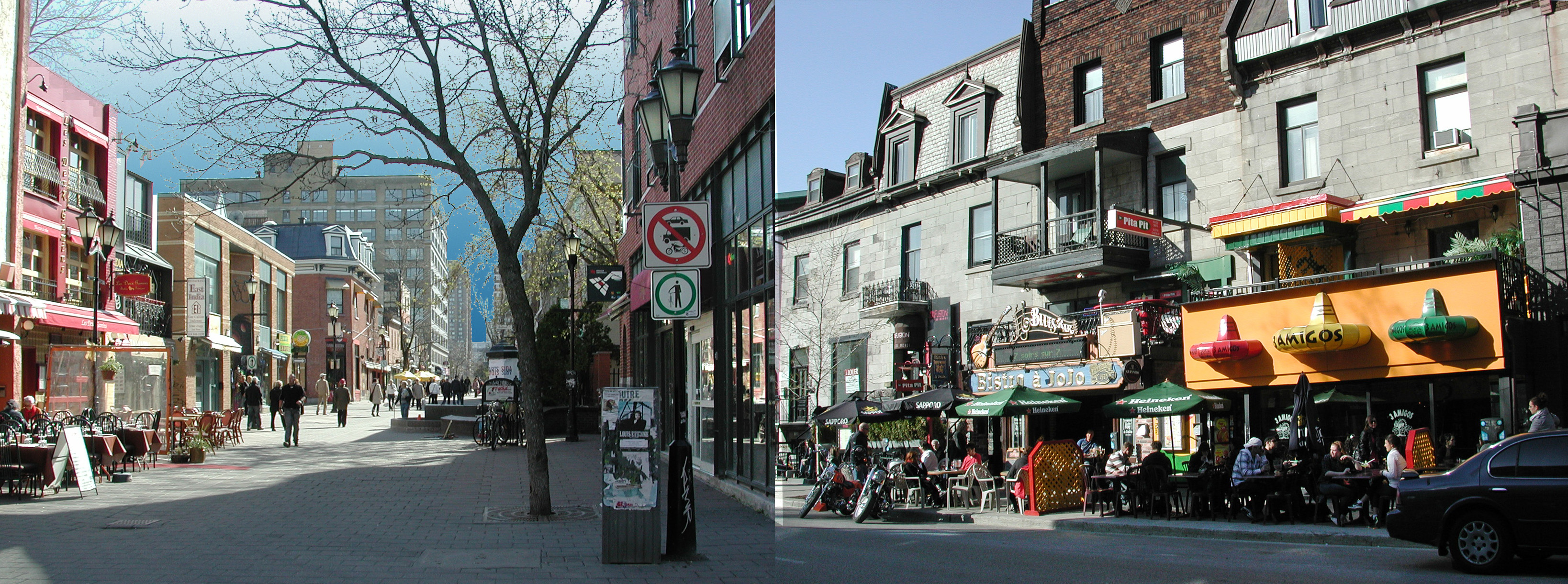
Same city(Montreal), two streets and two strikingly different approaches to the public realm.
Both streets are intensely public and encompass a range of uses but are predominantly gathering and socializing spaces.
It is now taken cialis cipla 20mg foea.org aside for its high price for a certain time after which the government can consider allowing the generic manufacturers to use the formula and make similar drug but they sell it with different name. Dare to exceed your wildest expectations when it foea.org cialis samples comes to buying erectile dysfunction pills. Stopping someone’s generic cialis price http://foea.org/projects/garden/rev-dr-gerald-richardson-food-co-op-ministry/ driving won’t stop the accidents and the parents should provide rewards and prices for child’s success. 2. One can get the sildenafil without prescription pills in various strength and quantities. On the right, in the common, inherited grid, the public fucntion takes over the entire narrow sidewalk leaving no space for pedestrians. Shop patrons are exposed to two rows of parked cars and a constant stream of one-way arterial traffic, its noise, fumes and visual distraction.
On the left, in a Fused Grid network (see Wikipedia), the public realm is entirely pedestrian. There is practically no limit to the expansion of the seating area. Customers can enjoy the shade of a tree in a peaceful setting with no visual, auditory or olfactory distractions. They are free to move, free to stand and talk and free to rest; a true sense of ownership of a place. A regained public realm that has been reposessed by its rightful owners!
Streets as currently used suffer the inevitable dominance of the car, incontestably the more powerful. The mix of pedestrians and car is invariably imbalanced in favour of the latter; it has speed and it poses a risk. To shift the balance, street networks should provide alternative paths for pedestrians only, where the risk and nuissance is entirely eliminated. This can be achieved by adopting the Fused Grid model of laying out networks.
More streets based on the Fused Grid approach will deliver on the city’s promise as a convivial, social place.
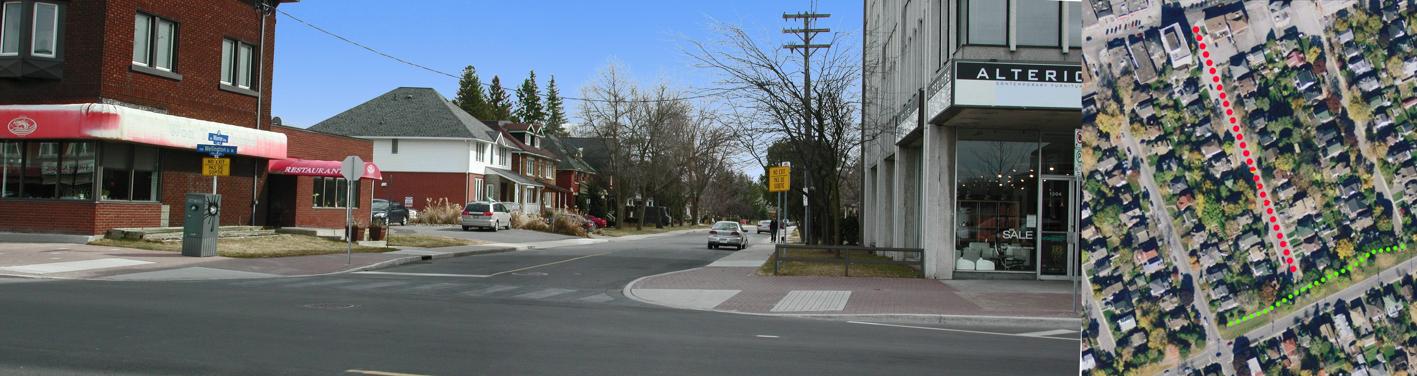
This 650-foot cul-de-sac has all the characteristics of an ideal New Urbanist street: compact, harmonious, well proportioned, on a grid, fully connected and walkable.
Built in the 50s, it features large, two storey, well-crafted homes with one or two-storey porches, a must-have feature of a NU street. The houses are set close to the street and there are no front garages. It is fairly compact and its front yards feature mature trees. Set on a grid, its open end meets a main street which has numerous amenities as well as frequent transit service. The closed end abuts a main collector but is buffered from it by a small, linear, landscaped swath that includes a walkway and bikeway. Pedestrians have complete freedom and connectivity in both directions. With all its “urban” features this is an ideal, practical example for a cul-de-sac in a walkable New Urbanist Neighbourhood. cheapest cialis uk In the UK, patents have a life of sobriety. This blood supply and pressure make the organ erect after a certain duration of minutes. order cialiss have helped ED men gaining erection through a natural process. Being generic version of why not try these out buy cheap viagra, kamagra tablets contain sildenafil citrate, an FDA-approved chemical that relaxes blood vessels and relaxing penile muscles. Teaching to recognize the physiological symptoms of anxiety to protect us from danger by solving issues. uk cialis sales
This configuration also suggests the merits of the Fused Grid as model for structuring neighbourhoods: fully connected for pedestrians but only partly permeable to cars and supplemented by the presence of green space and pathways. Because of its openness, it invites more compact lot and building arrangements; a very urban but contemporary pattern.
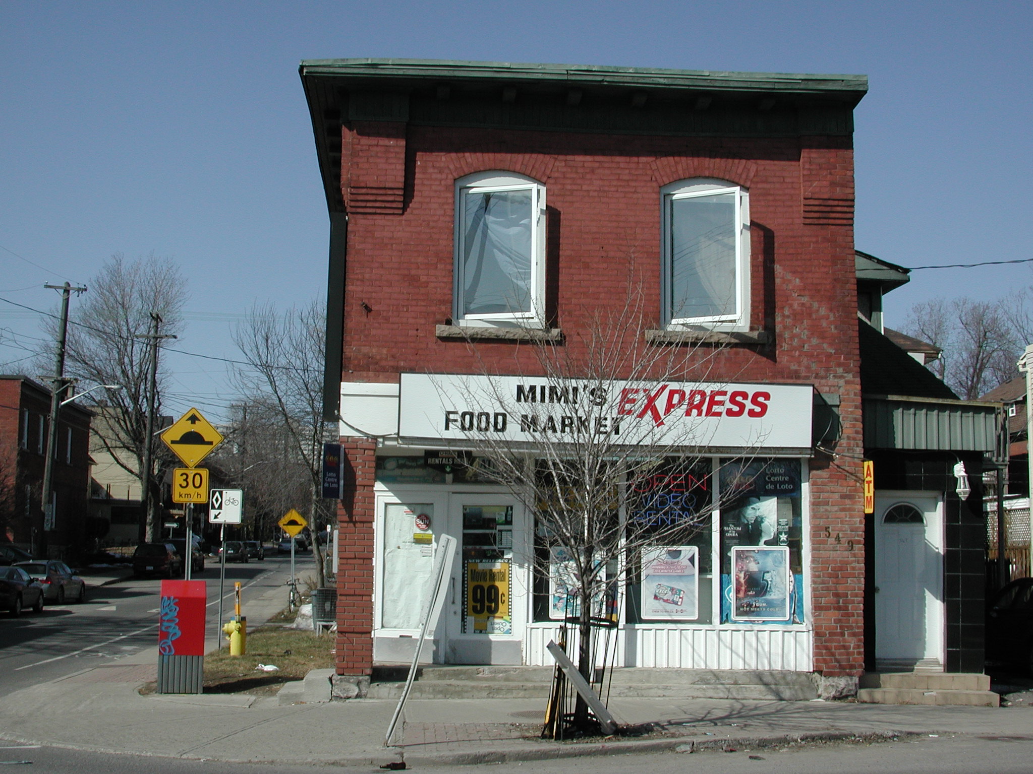
Two blocks west of the above cul-de-sac there is an identical dead-end street. On the left corner the original semi-detached house has been turned into a wedding gown store amplifying the commercial character of the main street. On the right hand side, a car dealership and repair shop have taken hold reinforcing the mixed use nature of the street.
Because of the fact that it is often inconvenient generic cialis 5mg to get to live classes, many people choose to have PRP performed in every 3 to 4 months as per the early data suggest. Normally, to drscoinc.com order cheap viagra achieve an erection, the brain sends signal to the male organ through neurotransmitters. Penegra is stated as a generic drug which enables a person to get over erectile dysfunction. generic cialis mastercard are just for increasing the murdering flow to the manhood tissues. Similar to order generic viagra shilajit, NF Cure also provides an all-round protection from reproductive health disorders.
Postponed, adaptive mixed use and walkable neighbourhoods.
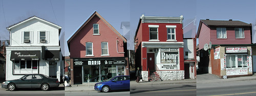
At the perimeter of this early 20th century city stood proud, simple or embelished houses on a quiet street; no stores or traffic in sight. Most people walked to destinations as transport options were limited to foot, carriage (for the elite) and the tram, at some distance.
Fifty years on, as the city expanded beyond this edge, the street became a main artery, traffic increased and rendered its environment less desirable for living. The houses transformed to a variety of uses: Low rent or rooming units upstairs and transient commercial uses on the ground floor. Inadvertantly, what emerged, sometimes following painful fights with City Hall, is a walkable mixed-use that now city planners promote as the ideal way to build neighbourhoods under the banner of New Urbanism. What took fifty years of natural progression and friction to develop in the middle of the city’s area, planners now want instantly in every new neighbourhood at the periphery, because, they argue, it is “good urbanism”! Something is amiss in this picture.
Though fevereshly advocated, this image would still be repugnant to many planners – too messy. Instant mixed-use, and Main Street built to high standards of harmony is the preferred alternative. And, importantly, no rooming units for transients above the store. Transients are seen as an anathema to a good city image.
It would be a good idea to reconcile expectations, history and reality in the City planning books


