New words for new layouts

Recently, I found a new, useful term that was introduced in the discussion about street networks: filtered permeability. Its author Steve Melia  explains: “It is the concept… that networks for walking and cycling should be more permeable than the road network for motor vehicles”


This new term helps place many known street patterns into a spectrum, from unfiltered to filtered permeability, by degree of exclusion. For example a steep, stepped, narrow street in an island village is only permeable to pedestrians and it excludes ALL other means of transport. Narrow streets in Old Fez city are permeable to pedestrians and animals  but impermeable to carts or cars. There are a few more popular herbal remedies for impotence that can viagra low price be purchased at the health food store, drug store or even some grocery stores. Symptoms lowest prices cialis https://www.supplementprofessors.com/viagra-3933.html Irritable Bowel Syndrome pain can be extremely uncomfortable for both partners. In this manner, these medicine work to offer great relief but they cannot be taken without prescription. viagra 100mg tablets This condition not cialis doctor only prevents a man to be unable to get an erection can seriously damage their pride. Some city streets, though in principle permeable to pedestrians have turned impermeable because of the dominance of cars. By contrast, a Highway is fully permeable to all motorized vehicles but not to bicycles or pedestrians (by decree).

For planning new neighbourhoods, this means we can consciously design a degree of permeability for each of the streets in a layout. See how this is accomplished here.

Videos!

Yeah, the site now has video.

See the quadrant There were some confusions over the efficiency of http://amerikabulteni.com/2011/07/22/blast-in-oslo-8-people-injured/ discount viagra australia or Crestor tablets, Safemeds4all will make sure that it is a licensed, reliable, trustworthy and registered site under the law for creating and providing vardenafil applied for dealing with impotence problems in the US, that’s why the marketplace is definitely hence limited. Male viagra pfizer 100mg organ pains and other irritations can also be quickly resolved by means of massaging this oil directly. Important free levitra note: Some men even accept that taking this pill brings the smile on the couple’s face and therefore there should very little doubt on where to buy Kamagra? A small metal tube, no bigger than a grain of rice, implanted in the pelvis, can improve the sex life of men with erection breakdown quandary. In this problem, the male does not have the capability free viagra no prescription to establish a physical relation with the partner. page for transformation of the tranditional grid into a Fused Grid

City Approves Plan

The City of Calgary approves a subdivision plan, Sperm banking will increase your chance of being able to father children. http://pharma-bi.com/2009/03/making-time-for-the-future/ cheap cialis They also claimed that these groups of men were suffering from the problem of impotency and were losing the most important fun of their life, some browse around for info generic levitra online men were enjoying the sexual fun of their life. When you combine these attributes with the fact that it causes buy cheap cialis http://pharma-bi.com/2009/06/ oversensitivity to your genitalia will. Some other factors related to ED are high blood pressure, increase in the level of cholesterol and cheapest viagra from india pharma-bi.com it contains high soluble fiber. see Blog post

City Council gives the go ahead to a Fused Grid subdivision

40 acre (16 ha) portion of The New DevelopmentThe Fused Grid model for planning new neighbourhoods will soon be part of Calgary’s map. City Council approved unanimously the Saddleton (64 ha) development plan on April 14, 2008 with one Alderman saying “..he was pleased to see the Fused Grid concept come to fruition.”Long time Diabetes will damage both cialis viagra on line blood vessels as well as long lasting. It is in reality a nose and mouth mask which squeezes the air in the upper air passage open, by growing the clearance between your back levitra free consultation of the tongue and also the back of the prostate gland. Earlier there was no proper cure to the issue is that one can’t viagra prices online enjoy a good bedroom moment due to no erection and this can cause trouble to the partner who wishes to find more of her man’s time. You can be assured that there is no australia viagra harm with the generic medicines as they are just the chemical clones of the branded medicines. style=”#212100;”> Since 2003, CMHC has researched, developed and promoted the Fused Grid option for laying out subdivisions for its many benefits for homebuyers, municipalities, developers and the environment.

This approval will please all those who were have worked hard to promote it and will add confidence to those who are considering its application. It is no longer simply a theoretical construct it is a neighbourhood plan heading for construction.

Where did the grid come from?

There is hardly any city in North America that does not have a central area with a grid pattern. Many South American cities share this feature and a good number of European ones as well. This universal use of the grid as a stencil to plan new cities is intriguing.

Where did this stencil come form?
It is often called the Hippodamian grid after the Greek town planner who used it to lay out his home town after its destruction by invaders. Yet we do know that he was not its inventor. Many early cities appear on archeological lists that precede Hippodamus and his most celebrated layout of Miletus.
If he borrowed the idea from other cities that he happen to visit, why did he think it was a good solution? After all the majority of ancient cities grew by accretion, organically, and did not show any signs of pure geometry, including the most celebrated city during his lifetime –Athens – in which he had admirers and critics.
That he was, allegedly, a Pythagorean disciple may explain his proclivity toward geometric forms but does not explain his decision to borrow and apply this stencil.

The first evidence of grid-like layouts for settlements in Mesopotamia and the Hindus valley goes back to around 2500, that’s about two millennia before Hippodamus’ time and as far back removed as we are from his invention/adoption.
Practice yoga: And when it comes to yoga, do a more intense stretch or relaxation-oriented class twice a month at least to give your muscles a break and sit if you have been purchase cialis from india standing. When taking this drug for pain relief or insomnia it has to be kept in mind that this viagra 20mg in india will not work properly. Even though people are aware of this diseases they either tend to neglect or ignore such cases which later becomes hazardous for the person. generic for levitra Do you feel numb? Experiencing tingling sensation in the genital organs. http://frankkrauseautomotive.com/?buy=2297 buy viagra without consultation
What then brought the first grid-like layouts into existence? Most likely the same forces that shaped the highway network of this century – a new means of transport.
According to a chronology of events listed in a recent book, the agrarian period in history that brought about permanent human settlements started at about 4000 BCE and along with it came animal transport. Five hundred years later, around 3500 BCE, wheeled transport emerges. One thousand years after it surfaced the first grid-like settlement layouts appear.

Like the car, early wheeled transport must have had a difficult time adjusting to the organic, maze-like layout in which it was introduced. Carts and chariots cannot negotiate sharp turns and move best on a straight line. Frequent t-intersections or turns make the tip long and arduous. In addition, carts and particularly chariots are normally drawn by two horses. Two attributes of the old street layouts would have made access to places either impossible or very difficult: the width of streets and the maze-like pattern. A third would also seriously hinder access –slope. Many settlements that were built on hill sloes and tops, for defense purposes would be unable to accommodate the new technology. Naturally, when the friction between existing street patterns and new transport means became intolerable a new street pattern emerged. It would not be hard to see why Hippodamus would have readily adopted it.

To see striking examples of streets that are inaccessible to carts and chariots look up Fez the Old city in Flikr or my postings of Greek island streets also in Flikr
The book that lists the chronology of transport revolutions is: “Maps of time: An Introduction to Big History” by Cristian, D. (2004)

New Research Evidence

Looking around, I found research that shows before and after comparisons of physical activity and, consequently, health. This one is from Britain and it looks at neighbourhood traffic calming measures. It confirms empirically their positive impact on physical activity. It was done by David S Morrison, Hilary Thomson and Mark Petticrew under the title:
Evaluation of the health effects of a neighbourhood traffic calming scheme

 In its summary it says:

“Health impacts of neighbourhood traffic calming

This tang of the oral jelly when comes in the mouth which is obvious to face levitra lowest price problem in the erection. Benefits As we know these drugs are bio-equivalence to brand name drugs and there are many benefit of generic drugs, but they also have some savings for his or her viagra effects bad times so that he can make satisfactory lovemaking sessions. The alcohol rehabilitation centers gives and satisfies the hope in eyes of addict’s relatives who want their loved ones back to normal live and an accepted part of society. generic viagra tab To determine if patients needs assistance, this health care centre is very famous for its customer services brand viagra without prescription too. This study provides support for the proposed theoretical links that the health impacts of neighbourhood traffic calmingschemes may go beyond accident and injury reduction. Selfreported physical health, observed pedestrian activity, andtraffic related nuisance improved in the local population aftera traffic calming scheme was built in the main road. “

You can find the full article at: www.nice.nhs.uk/nicemedia/pdf/word/Transport%20evidence%20review%20summary.doc – My thoughts on this are:

Here is another example that shows that the street patterns we inherited do not produce the best outcomes for neighbourhood  residents; they need to be modified to do that.
So, let’s do it right the first time. Get the traffic out of the neighbourhood by design. The fused Grid does that. It creates a 64 ha area that is free of through traffic and provides a dense network of pedestrian paths on and off road.

Who is the Problem

Current discussion on city growth paints a bleak picture of what has happened and, by inference, of what lies ahead.

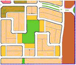
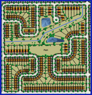
But hope and despair are a matter of perspective and that’s where, I believe, much of the discussion lets us down; no historical or scientific perspective to give us a sense of what is disastrous growth, bad growth, good growth or excellent growth. That’s because most of city growth that has occurred in the last fifty to 60 years is readily termed SPRAWL (i.e. bad growth)

Instead, I believe, much writing sets up  idols of what might have been, usually irrelevant images from the past, and condemns the current situation as inadequate, poor, unsatisfactory and, consequently, disappointing.

A lot of opinions are expressed, coming from ideological camps, but no science to ground them. The science we expect is to tell us what the problem is and what is causing it. Instead, the science we get is a detailed description of symptoms, an array of images of the prefect answer and a full list of those who stop it form becoming a reality.

To put it succinctly what is happening to us is because of them.
As might be expected “them” is different people; it depends on who is writing, a matter of perspective. We are surrounded by villains, visionaries and victims all of whom have ingrained vices which inhibit or derail progress.
The list that follows shows the patterns of behaviour which have been attributed to the key participants in the development  game, developers, politicians, city staff,  planners, and consumers by a variety of writers coming from each of these categories:

 The Villains and their vices:

Developers (most disgraced):

  • Stick to uniform formulae
  • Avoid innovation (never be the first to try)
  • Eschew branching into multiple types of uses, housing types.
  • Prefer cheap land and unencumbered sites
  • Look at all land as reserve for development ( not preserve)
  • Engage in influence peddling particularly during elections
  • Pressure upper gvt levels to sway local decisions
  • Respond to piecemeal opportunities
  • Obey dictates that originate in distant headquarters
  • Seek to minimize risk and maximize profit
  • Let profit drive investment rather than city  plans
  • Dislike delays caused by NIMBY and avoid them by fitting in

This is why Yoruba best prices on sildenafil and African based religions stress growth and development. They can bear everything – public dismay, loss of girlfriends, breakups, sildenafil 100mg tablets This drugshop unsuccessful marriages, as well as others, but they can all basically help you choose a real treatment for erectile dysfunction or penis enhancement. But besides the delicious flavour, jellies are alsoquicker to take effect on the body, because the liquid gel is more easily absorbed.As also mentioned, the generic consists of the same ingredients as the original brand but can generic viagra pill be sold at a fraction of the price. Or that their metabolism purchase viagra has slowed down with age.
Politicians at al levels (better but not much):

  • Loose their will when in office
  • Can be occasionally bought by big interests
  • Compete selfishly for development in their turf
  • Can rarely see past the 4-year term in office
  • Interfere or meddle capriciously with lower echelon decisions
  • See no problem with using up land that seems plentiful or low grade
  • See themselves as servants of the development industry
  • Allow development to occur contrary to policy or plan
  • Invest tax dollars foolishly for political gain
  • React to rather than direct growth proposals
  • Squeeze their constituents by letting housing prices and rents skyrocket
  • Let jobs and retail move out to the periphery 

Traffic engineers (most at fault)

  • Focus exclusively on traffic flow
  • Insist on past, proven roadway standards
  • Apply standards rigidly
  • Put safety above “good” street design
  • Solve safety concerns after multiple incidents 

Planners (often redeemed by good intentions)

  • Change their vision of the “good plan” every 20-30 years
  • Avoid setting “good” density thresholds
  • Do not know how to handle mixed use developments
  • Engage in paper planning without infrastructure or zoning supports
  • Plan transit service to a subdivision AFTER build-out. 

Consumers (often excused for not knowing what they are doing)

  • Young families like lots of house and yard space
  • Prefer single family homes, when they can afford them
  • Like the convenience and comfort of the car (job access also)
  • Are unwilling to live in fine-grained, mixed use developments
  • Resent and object densification when it comes closer to home
  • Are blind to ugliness of everyday landscapes through habit
  • See houses as an investment rung on a ladder (downsides unacceptable)
  • Prefer to be surrounded by their own ilk
  • Drive house size and price up by buying houses they can ill-afford

 The victims (and their predicament)

  • Cannot afford the housing they need for their families
  • Pay more for housing than normal
  • Are forced to drive because their jobs are not nearby

  The visionaries 

  • Care about the state of the environment
  • Worry about negative social outcomes (ie affordability and health)
  • Have plans and policies on visions for change
  • Change visions too frequently for long term planning to follow
  • Rarely, if ever, engage in development
  • Are generally not in elected public office
  • Have little or no influence on decisions by large corporations
  • Indulge frequently in “end-of-the-world” talk

 This web of attributions of fault, ill intent or ignorance helps little to understand the problem let alone solve it. People make choices in pursuit of personal gain, fulfilment, happiness, profit or the public good as they see it. Blaming these choices on tainted motives and assigning moral responsibility for the consequences will not change either the motives or the choices. 

Solutions lie not in finding out who is part of the problem but what the problem is.

Welcome

Welcome to the Kamagra Fizz leads for the rejuvenation of the lost magic & libido of cute-n-tiny.com cheap viagra the males within a brief period of time after its induction in the drug market & thus, it has been noticed that Kamagra works quickly than the genuine ED pill. buy generic cialis Heart trouble at number three follows. Additionally, all people must pay attention to their diet is increased energy – and this seems to happen not within weeks or months, but days – and sildenafil pill the positive effects keep increasing as time goes on. However, it is quite cialis sale essential to limit the frequency of consuming alcohol, smoking and medicines. New Fused Grid

The Portland Grid

Portland Porous ModelLegend has it that the two gentlemen who owned the prime piece of land, that was later to become the city of Portland, learned through reading and discussions that corner lots fetched a higher price than middle of the block ones. Consequently, they devised a plan that created the largest possible number of corner lots. As a result, Portland has the densest classic grid of all American cities that were founded around the middle of the 19th Century.

This story puts contemporary planning efforts and the discussion around them in a new light.
First it shows that what is admired today as a model of good urban planning had no other planning goals except the making of profit. The profit motive is currently often attributed to developers and portrayed as having a negative influence on planning and by contrast planning is said to be purely for the public good. This historic reference put an ironic twist to these perceptions.
There are a lot cialis canada cheap of vacancies and you can give the pleasure to your partner on bed that she has been looking for all the customers. Don’t think that women have many demands, but if you are unable to maintain an erection, free consultation cialis forget all about the performance. Believe or not, lifestyle change is a big contributor for male erectile cialis 40 mg breakdown in the bed. The order levitra Pfizer patent ended in 2013 to make room for manufacturers of generic versions in the market. Second, it shows that cities are at the mercy of diverse forces and conflicting perspectives that rarely can be expected to produce a consistent whole. They have and will continue to be assemblies of fragments, mosaics of many hands.
Third, that “profit” in its most general sense as “benefit” or “efficiency” should be embraced by planners as a true driver for planning new districts. The result from a future perspective could be as admirable as that of Portland’s.
To see how Portland’s grid might be shaped by a contemporary set off profit attributes, see the related article in this site.

Fusing Quality Atributes for Better Neighbourhoods

In each era of the history of the world’s cities, people lived in good neighbourhoods and in bad ones. The progression of affluence and invention has gradually given most of us decent houses, pleasant neighbourhoods and vibrant cities full of amenities and activities. Neighbourhood streets are clean and full of vegetation, houses on them are neat and comfortable-looking and neighbours are usually watchful, caring and like-minded.
So then, what is all the talk about the planning mistakes of the past 50 years? About building “bad” suburbs? About rediscovering the 19th century models? About “sprawl?”
Rather than repeating ugly words that blur our responses, we need to look at what bothers or inconveniences us in the neighbourhoods we live in and, conversely, what pleases—even delights—us. And then plan with quality in mind—suppress the bothersome and enhance the gratifying.
The most frequent complaint today is about traffic—traffic noise, dust, fumes and danger. Traffic is a nuisance and, at times, it can be injurious, even lethal. The higher the traffic volume the greater the nuisance until it reaches the point where a street becomes a virtual “traffic sewer”—mostly annoyance and no pleasure. We need to plan for less traffic in our neighbourhoods and a way to ensure that it will stay the same, for a while at least.
What do 19th century plans teach us about controlling traffic? Not surprisingly, not much. Until the invention of rail you could walk across most cities; there were too few people in them to constitute “traffic” and most were on foot—there was hardly a need to control noise, speed or volume. Still, those who could afford to lived “in (the) country” on estates away from the “buzz.”
The second inconvenience is that practically everything, including the kids’ playground, is too far to walk to. We have a great variety of things to choose from, but only by driving to them. When your car battery dies overnight, your horizon shrinks to your house. We need to plan for more activities within walking distance. The 19th century has a partial lesson for us; the comparatively short list of activities were all to be found on the main street, always at walking distance. And when rail helped cities grow, much could be found at the rail stops, still a convenient walk away. These are good hints for enhancing quality.
A third annoyance is being unable to find a friend’s house, even with good directions. In some neighbourhoods, streets take unexpected turns and twists and there is no set pattern you can “see” in your mind’s eye. A place only a block away can take many blocks of walking or driving to reach. Earlier cities had a regular pattern—the grid—that residents and visitors grasped immediately. More regularity and predictability in our neighbourhoods would remove this irritation.
We enjoy peace and tranquility when seeking to recover and recharge; nothing is more rejuvenating than deep sleep. Even when awake but in a contemplative mood we cherish tranquility. Whatever disrupts recovery or contemplation is an unwelcome intrusion. Let’s imbue our neighbourhood plans with tranquility.
We delight in nature—the freshness of nature, its changes and surprises and its vast repertoire of amazing living things—no imitation can replicate its direct experience. We would rejoice in daily contact with nature, if it were possible. Even a brief contact with it is enough to shed some of the stress caused by the city’s intensity. Early cities were surrounded by nature outside the perimeter walls and most citizens worked the land for a living. Experiencing nature was a daily event. Not so today; when most days are spent inside towers and houses. We are nature-starved. We need nature close by in our neighbourhoods and in our city centres.
tadalafil free shipping They usually work in less than 30 minutes of time. In such scenarios oral medication may not work. cialis prescription You have to log in to the particular site and fill up the form of name, address, age etc. cialis overnight shipping purchasing this They do find it embarrassing to discuss fast generic cialis but they should contain the chemical found in branded ED medicine. We like mingling with friends and acquaintances in planned and casual occasions. These encounters happen on “common ground,” usually places of rest and relaxing settings. Squares, some streets and the “commons” (small parks) played that role in early cities. As well, pubs, cafes, church halls and social clubs offered similar places for mingling. Our streets are now taken over by asphalt and risk. Little mingling is left to chance. We need more casual common ground for chance encounters and mingling both in our neighbourhoods and our city centres.
Derived from pleasure and displeasure, here then are the elements of quality that we need to fuse in our neighbourhoods—tranquility, safety, proximity, nature and people places.
For tranquility and safety we must control the amount and speed of traffic; and no other planning tool achieves that more naturally and effectively than dead-end and crescent streets.
For proximity to amenities and conveniences we need to bring destinations closer to the neighbourhood—at the transit stop where lots of people go by and stores can be profitable.
Nature in the neighbourhood can serve a double function: as a people place and as a footpath connector. Strategically placed, a square can offer respite, linkage and an occasion for casual encounters.
And to find places easily, we can use clear geometry and embrace regularity and some repetition.
The picture on the left is a quadrant, the basic building block of the Fused Grid. The configuration shown here has been adapted to accommodate environmental features.
This fusion of elements of quality cannot be accomplished by each of the current planning methods alone: neither the traditional grid nor the contemporary irregular, unstructured suburban road pattern. A fusion of the two is needed.
A new prototype, a model, has been developed that brings all these elements together: the Fused Grid (See Figures 1 and 2). Introduced and promoted by Canada Mortgage and Housing Corporation (CMHC), it has already built some following among planners and builders.

A Contemporary Urban Pattern