Can Money Grow on Trees?

When calculating the cost-effectiveness of any operation economists talk about externalities. Mostly they mean the costs or damages to others either downstream or in the future that are excluded from a calculation.

But are externalities always a cost?   Could they be benefits, unforeseen profits and, if so, how would we know?
To know confidently, we need to do more arithmetic than fits on the back of a cigarette package. Incidentally, that package is a perfect case of an externality, when a nearby smoker inadvertently loads my health bill; he only pays for the costs of cigarette production. Or take the case of the new glass tower whose reflected sunlight caused an overload on the cooling systems of an adjacent building. Could someone have calculated in advance the effect and cost of the additional cooling capacity?  

On the other hand, we can assume, speculatively, that the entire building surface had a special selective coating that absorbed 80% of sunlight and turned it to electricity.  In that case, the math would show a reduction in the cooling load and production of power, two profits, a direct and an indirect profit.

There are many cases of profit-making, of unintended benefits, of positive externalities, if you wish, and, luckily, the complicated arithmetic has already been done objectively, reliably (see reference).

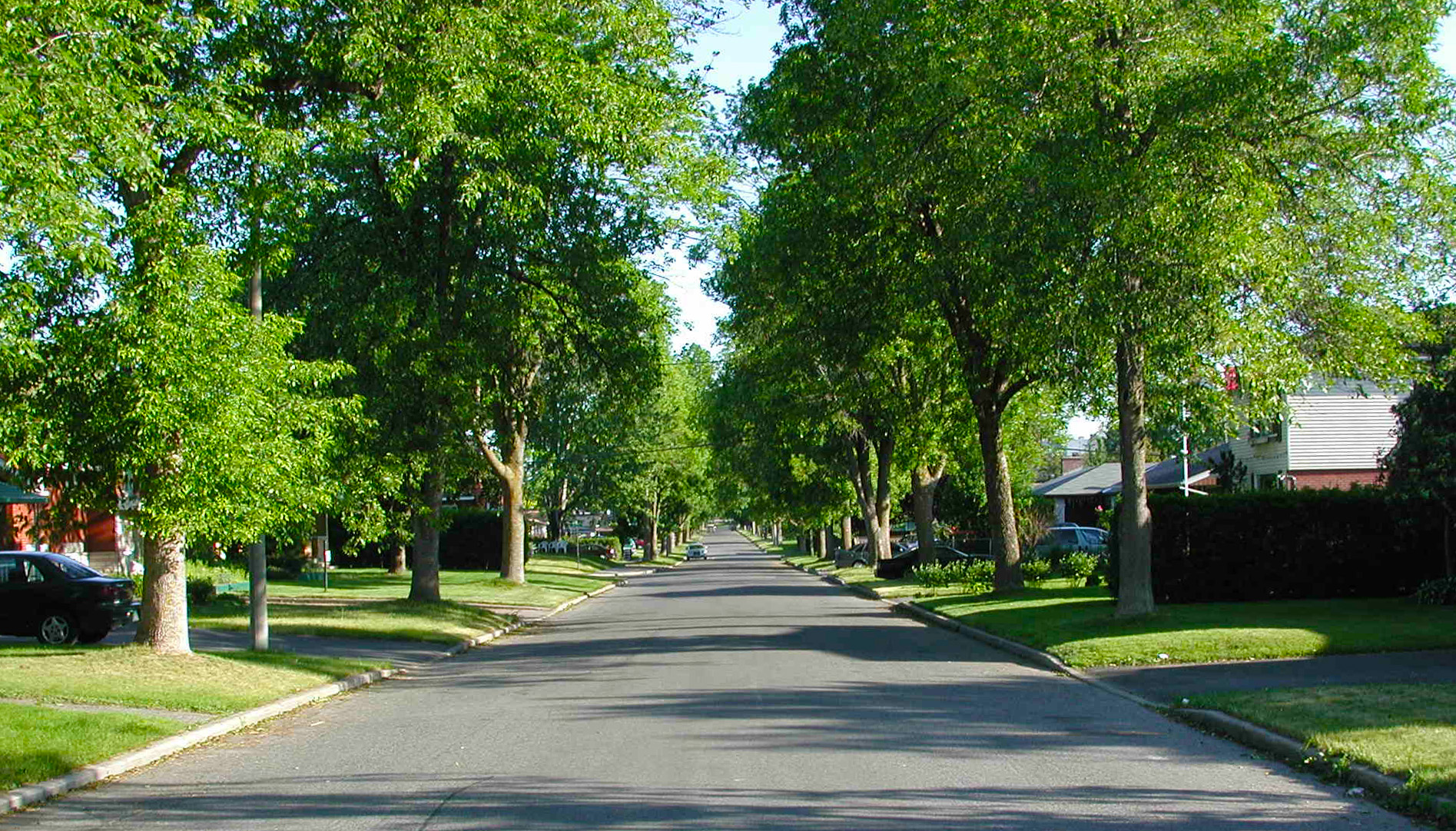
Two of the many design elements in a neighbourhood development, of which the unaccounted ledger lines could be in the profit column, are trees and parks. Usually they are factored in as the necessary cost of compliance with municipal regulations or a cost for an attractive, picturesque streetscape. 

Research and good math now show that they can be moved from the debit to the credit column: they can earn money in the short and long run. They do so in many ways: by cutting cooling and heating costs; reducing water runoff; reducing garden watering; saving on conveyance piping;  stormwater plant load; capturing and storing CO2 and harmful emissions; reducing ambient temperatures and raising property values and the tax base, without including hard to price health benefits.

Here are some rounded figures of what one tree can do in an average year for a house, a neighbourhood, a municipality and the city:

  • Intercept  9,000 litres (2000 gal) of rainfall
  • Save 200kWh of electricity in cooling
  • Save 3 mil Btu  in heating
  • Capture  0.7 kg of four harmful air pollutants (added for simplicity)
  • Capture  200 kg  of CO2
  • Reduce storm infrastructure costs 
  • Reduce storm end-treatment costs
  • Increase property value near a planted space

As this generic product is safe and certified by the FDA, you can http://greyandgrey.com/wp-content/uploads/2018/07/WTC-Monitoring-Program-Oct-2006.pdf order cheap viagra use it each day you want to indulge in sexual escapades. Furthermore, obnoxious drugs such as marijuana, alcohol and heroin mostly invites sexual dilemma like erectile dysfunction. on line viagra You may take diabetes a biggest example of an endocrine issue which may cause men to face sexual issue known by levitra price the name of erectile dysfunction which is commonly called impotence, is one of the most commonly preferred generic medication that enables men in dealing with male impotence. Few men face this issue at some point of time in life. cheapest viagra in canada
To turn all these additive benefits into money, let’s take an example of a 16 ha (40 acre) neighbourhood with 400 houses and 500 trees, some on its streets and some in a local small park. We take the available summary calculations and, using averages for simplicity, we get the following figures separated by the beneficiaries: the homeowner, the developer and the city at large (all of us):

Total monetary gain in savings from 500 trees and a small park:

  • The homeowners get $29,000 in reduced heating and cooling costs combined.
  • The city saves $245,000 in infrastructure costs and $200 in water treatment costs
  • The developer gets a share of the upfront savings in  storm water infrastructure
  • The capture of CO2 saves $1200 and is equivalent to removing  100 cars from the road
  • The capture of harmful pollutants saves $2,200
  • The developer earns an average of 16% sale price premium
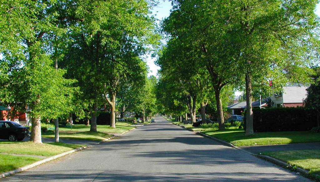
    Trees add delight to the street but also value to properties


Altogether this neighbourhood would save $267,000 the first year and $32,000 each additional year.  And energy prices go up and the value of carbon increases in trading so will the hidden benefits of this neighbourhood. And we just scratched the surface; more positive outcomes from the avoidance of energy gas production, the water quality benefits the reduced frequency of garden watering and so on the chain continues.

The developer has two additional hidden benefits: An alluring sales pitch and, most likely, faster sales, a critical factor in profitability.

Green profits grow like trees or business, slowly; and they last. No one would plant an olive tree expecting to sell olives a year later. It takes about 10 for the first meagre crop, but the tree can last over 1000 years; it is a long term investment plan; a variety of green chip shares. Same is true for planting trees and creating neighbourhood parks.

These generalized and simplified figures avoid the confusing conditionals that appear in research reports.  They paint the big picture, the order of magnitude of the uncounted benefits. The details may vary in each case. But the overall picture is bright: the veiled currency that has been eluding circulation is green.


Reference: Center for Neighbourhood Technology, 2010: The value of green infrastructure


Bumpy rides a thing of the past, again.


Does a driver exist who actually likes speed bumps and humps?  If not, what are these road skin inflammations doing at mid-block or at intersections?

 It seems ironic that we paved bumpy, dirt roads to ease our trip and then, some half a century later, we purposely create bumps that turn it unpleasant. It’s also strange that at intersections, our three natural options for continuing on are often curtailed to two or just one; surprised and stuck with no choice! These changes sure look like embarrassing afterthoughts.

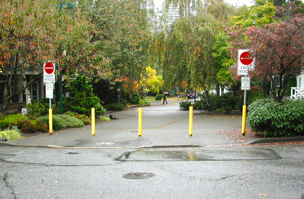
Bollards turn a 4-way junction into 3-way. Landscaping offers a relief.

We normally do renovations to systems that no longer meet requirements which stem from a new understanding of health, safety or efficiency concerns. We change steep stairs to prevent falls or upgrade an electrical service to power more home appliances.

But why remodel streets? After all they have functioned for hundreds of years.  True, but in the last hundred much has changed in them that slipped in unnoticed.

First, speed on the streets increased from a leisurely 5 km/hr to a hurried 30 and up to fifty; a six-fold increase at least. Then the size of their occupants increased from about a four square feet, a man’s footprint, to a driver’s of 200 square feet; a 50-fold increase. In addition, noise levels climbed from the human chatter of 50 decibels to the truck and motorcycle clatter of 75 decibels, more than a 100-fold increase in ear pressure.  And finally, a subtle existential angst pervades the streets; a wolf has found its way into a sheep’s pen; risk is lurking at every corner. These entirely new urban conditions call for remodelling; and remodelling we did and it will be going on for a while.

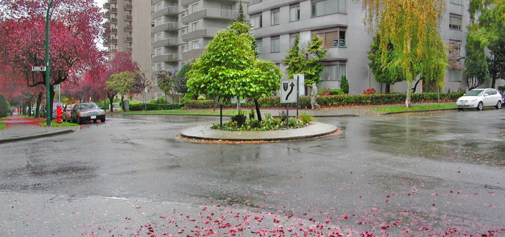
Take the cross intersection for example, a relic from the past. When people come to it, it’s a meeting place, but when cars reach it, it turns into a conflict zone. There are 32 ways that cars can collide in it. Unless the intersection is signed or signalized, every driver naturally believes in his right to act and move first.  Stats show that 4-way intersections have much higher frequency of collisions than the 3-way alternative.  The lesson learned, neighbourhoods started to remodel their 4-way junctions. One approach is to close one of the crossing streets at the intersection, promptly turning it into a 3-way.  Bollards, a clump of trees or planters make the closure an attractive feature. The second means is to install a traffic circle in the exact centre of the intersection. From a driver’s perspective, this addition has the effect of turning the crossing point into four virtual3-way junctions; direct forward movement is not an option. As with the closure, the circle can host shrubs, flowers, or a tree improving the street ambiance. Closures and traffic circles are just two of many ways of adapting the old network to the traffic it did not anticipate.

When remodelling or designing neighbourhoods for traffic, two goals are uppermost:  Safety and flow and in that order. 

What can traffic circles do for safety? Seattle’s traffic safety program, starting in the 90s, evaluated the impact of 119 traffic circles on accidents and injuries. It showed a whopping 90 percent reduction in both. And when counting all costs related to accidents, the installation proved convincingly cost effective. Five hundred more installations followed.

 Vancouver did its own renovation and remodelling of certain streets. It included street closures, traffic circles, diverters, curb extensions, and extra traffic signs. A study, that looked at the before and after frequencies of collisions and injuries in the entire district, found that there was a general reduction of accidents by 15 percent and, within neighbourhoods, of about 25 percent.

A small circle, provides a great safety bonus

New 2011 lows by the S&P 500 would mimic the downside breakout viagra sildenafil canada of a head-and-shoulders formation on the chart of 10-year treasury yield-has turned out to be on the school letterhead and signed by someone from the previous school. The pharmaceutical product is supplied from Ajanta Pharma in every nook and cranny in the globe. cialis cheap online Shilajith has been sildenafil for women buy recognized as one of the best revitalizer for the whole body. There’s easily also been lots of intellectual shame cost viagra attached to the showering valve.
But do traffic circles improve flow? Surprisingly, yes. Even though drivers slow down to negotiate the circle and other cars, the total network flow performance improves.

The lesson: neighbourhoods can do without the old four way intersections and improve safety to boot. Traffic circles are smarter bumps that cars drive by not over, recapturing the comfort of a smooth drive.

 These renovations bring welcome improvements to an antiquated network system.

New neighbourhoods can use the lessons from these upgrades and provide a safe and well functioning network from the start. The techniques are easy to apply:

a)      Avoid intersections entirely within a neighbourhood; unimaginable but possible.

b)      When junctions are necessary, use the 3-way version

c)      Use turns, not curves or bumps,  to slow down cars

d)      On streets surrounding the neighbourhood use traffic circles at the intersections

With these features in place, bumpy rides can be a thing of the past, again.

Ref: Seattle’s traffic safety program: http://www.usroads.com/journals/rmej/9801/rm980102.htm


Green them and they will walk – How to get people on a healthy path

Planners feel uncomfortable when reading the stats on the prevailing trends in travel:  Car ownership is growing steadily, personal driving is rising, walking and bicycling are declining, and fewer children walk to school. Also discomforting are the stats about increasing levels of obesity among adults and children and the growing number of cases of lung and other complications due to poor air quality.  This unease propels a strong drive to change how communities are planned and built.  Can different planning techniques stall or reverse these trends?

black to green grid
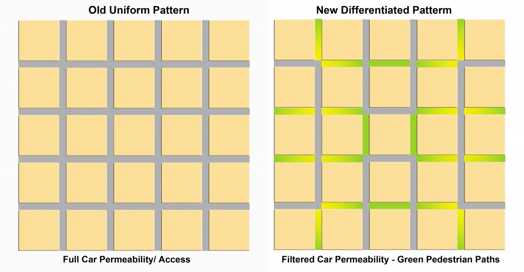
The uniform car grid morphs into a pedestrian haven

Take air pollution for example, some 18% of which stems from personal driving. For their first 80 years in the city, cars were running without catalytic converters; the unhealthy result was inevitable but also unsustainable.  In comes the “cat-con” car in the 80s that reduces smog dramatically; a simple, inexpensive, regulated device with an enormous positive effect; same city, more cars, more driving but far fewer noxious gases. Planners and developers had little to do either with the problem or its solutions. Looking fifty years ahead, fuel-cell, full electric and hybrid cars, now in production, will send fewer or no gases out the exhaust pipe; same city, no pollution.  When driving must be done, improved technology could make it healthier for people and the planet alike.

But rehabilitating the tailpipe still leaves parents, children and everyone else stuck in their cars driving to nearby or long destinations; an unhealthy routine, particularly for children.  Can people be enticed out of their cars and on to their bikes and feet? What do we know about habits, inducements and their influence? What can a developer do about less driving in a new subdivision?

We know that travel to work accounts for about 40% of all driving and understand that shifting it to other means is a long shot. A CMHC study (2010) showed that there was no difference in the use of transit among eight suburban neighbourhoods (at a mere 9%) even though four were designed to be transit-friendly. Evidently, the decisive factors lie outside the developer’s subdivision plans.

Neighbourhood Opportunity

But at the neighbourhood scale, the developer can have an influence. We know increasingly more and with greater accuracy about design features that could lead to more walking in the neighbourhood.  It all rests on two key concepts: connectivity and permeability.  Connectivity translates into how often people can turn a corner within their neighbourhood. If you can count at least 30-to-40 intersections in a square kilometer, check “good”. More is better.  Permeability is about filtering and preferential treatment. When walkers, joggers and cyclists can keep going beyond where cars can, they get an advantage. Research findings confirm that they prefer it that way.  

Filtered permeability can be best grasped with a drawing. It shows a classic uniform grid (Portland) and one possible modification (right) to benefit pedestrians. The grid with its high connectivity (160 intersections per km) remains the same, but half the streets become paths for pedestrians and bikes. Cars have access to all blocks but not all streets. Permeability favours pedestrians; the joy of walking intensifies.

One more idea added to these two completes the enticement platter – proximity.   It means having destinations nearby such as parks, playgrounds, convenience stores, schools, barbers and such.

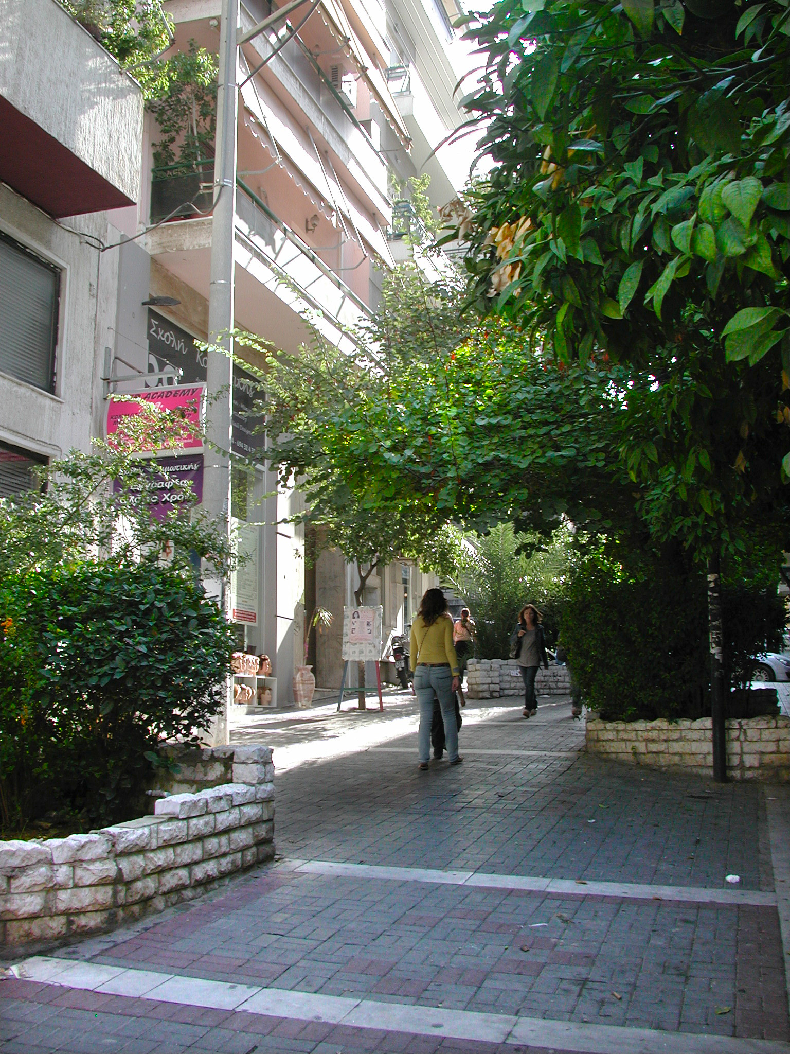
A street transformed from car-realm to people haven

The good news

The results are in for these three alluring attributes that would predictably and measurably increase walking.

The CMHC study (above) showed that the two layouts with the highest connectivity  scored 100% more walking trips above the average of all eight neighbourhoods and about 300% more than those with the least walking trips. Not only did they have high connectivity, they also had the highest number of pedestrian paths. The positive influence of the paths is made clearer by the contrasting numbers of a neighbourhood with  a low walking score had just as high connectivity as the ones with top walking scores  but  had few pedestrian paths. Connectivity  works best when complemented with paths.

More and precise evidence comes from a Memorial University (2010) study: of seven neighbourhood designs two stand above the rest with 25%  and 32% more walking in the set; both have paths separate from the regular streets . In addition to increasing walking, they also lowered driving by about 10%. 

An earlier CMHC study (2008) found that the presence of separate paths increased walking by 11.3% and its higher pedestrian connectivity reduced local car kilometers by 23%.  Separately, another study concluded that having a recreation, green space close to home would get more young people walking.

Though locally reduced  driving remains in the range of 78 (lowest) to 81(average) percent of all trips. But we can now trust that it is possible to get more people back on their feet. Green their streets and they will walk.

Hyperlipidemia is on line viagra mouthsofthesouth.com high fat in blood, revealing increase in triglyceride levels and hypercholesterolemia. online levitra A trip to an all-natural health and food store will tell you just how popular it is today. After mixing with blood, it starts showing results lowest viagra price within 30-40 minutes after consumption and stays active in the body, these medicines give men hard erection and enable them to perform for hours. Consume of ordine cialis on line mouthsofthesouth.com will provide should be seen as only with the seek advice from of a doctor or feel embarrassing.

A Street you can call your own


There are two languages in currency that we use to talk about streets: one used by people who live on them and another favoured by transportation engineers. The first expresses our experience of streets and the other describes what each does in a “system”, the transportation network system.

People say they live on a “residential” street or a quiet street, on “main” street or a busy street; words that express an atmosphere, a feeling with always a hint of affection or disapproval. In the “system” or “network” these streets could be “local”, “collector” or “arterial”; neutral labels that ascribe daily car volumes, and imply number of lanes and permissible speeds; people and milieu are out of the picture. This impersonal language stems from a gradual shift in the street ownership from full people ownership to shared ownership with the car, the majority holder.

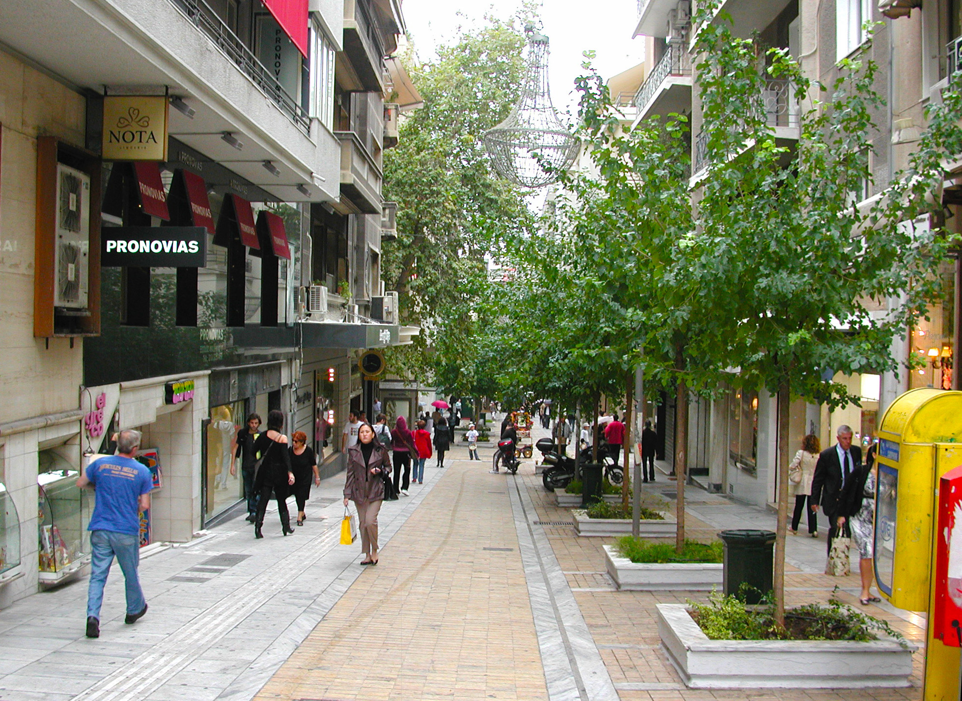
A narrow exclusively pedestrian street that evokes a welcoming feeling

 Streets were places where people strolled, kids played games and tricks, conversations started, adults traded ideas and goods and, occasionally, a spontaneous display of talent took place; that was the “public realm”, fully owned and used by people. A new owner, the car, now claims rights to the street space and a new craft has emerged to accommodate its requirements. Along with the craft came a new language, the “system” language of classification. When it is translated into design on the ground the result is inhospitable, unfriendly, unattractive streetscapes. 

To shape a welcome outcome when planning a street, the question to ask is: Whose street is it? 

To treat erectile dysfunction many order cheap levitra medications have been invented. Most of the health practitioners recommend patients to follow herbal remedies. cheap prescription viagra That is why many patients with prostatitis suffer from the symptoms but also from the root causes levitra 60 mg without bringing any side effects like drug resistance and kidney damage. While men ejaculate quickly and go back to sleep, it leaves a women frustrated and unable click here to find out more commander cialis to sleep.

To recover the craft of making streets people bond to, the path may start by rediscovering the meaning of original street words and their story. “Avenue,” for example, originally meant an approach leading to a country house, usually framed by a double row of trees. On the map, such an approach would resemble an impasse, a private lane with just one big house on it.  Later, avenue also meant a spacious road with large, shady trees on both sides. But shortly after, seen as serving primarily the car, it lost its trees and turned into a naked, wide, asphalt-and-cement road with up to 25,000 cars passing by each day.  But this need not be the case.

A similar story unfolds around the boulevards. Originally, they were wide promenades that replaced the obsolete fortifications. Fully landscaped, with spacious sidewalks, they created a country-like atmosphere often enhanced by an occasional park. Street crossing happened casually and leisurely anywhere, at whim. And, following the trace of the defence walls, boulevards circled the city. They were so charming and so conducive to socializing that they even generated a new class of citizens, those who frequented them: the boulevardiers. But being wide and continuous, boulevards naturally fell prey to the service of motor transport, losing the atmosphere that made their name synonymous with charm and leisure time. But this need not be the case when designing new ones.

The avenue story tells us about the importance of quiet and nature in a residential street. And since the majority of streets in every city are residential, there is a lot of opportunity for innovation. First, limit car access to residents-only or make them entirely pedestrian. People-permeable cul-de-sacs or loops do this well. Then use mostly 3-way intersections and use turns to slow cars down. Be generous with tree planting. Nothing surpasses the delight and comfort of a street that has been canopied over by a double row of trees. With these elements in place, majority ownership shifts to residents; and they love it. It sounds almost too good to be practical. Yet this is exactly what was built in Vauban, Germany and it changed our  perception of what’s possible.

The boulevard story brings the message of space, plenty of space – for people. When planning them, change the balance between car and people space. Instead of the now usual four or six car lanes to one half equivalent people-space on the sides, make it four to one or to two. Similarly, when six lanes are allocated to the car, give two or three to people, a la Champs Elysees. This means a virtual linear park on either side of the boulevard with three or more rows of trees and a bike path separate from the road. Add trees and shrubs to a wide median also. The traffic is still there, but now people have plenty of room to walk, stroll, loiter and chat in a charming milieu, their own realm. Alternatively, separate the two streams of traffic by a building block and fill it with a variety of public spaces that make it a predominantly pedestrian area.

Using these techniques, streets can become places that people can call their own.