Category Archives: Fused Grid Applied

neighbourhood plans where the fused grid has been applied

A Fused Grid Milestone: Red Deer, AB planning guidelines


has been reached in the adoption of the Fused Grid model – embedding its principles in a municipal standards book.


While the fused grid is being vigorously debated in planning and academic circles, as any new idea normally would, an obstacle to its implementation by pragmatic developers remained: municipal policies set on a whimsical view of what constitutes a “good neighbourhood plan”.

Figure 1: A small park serves also as a connector between two streets

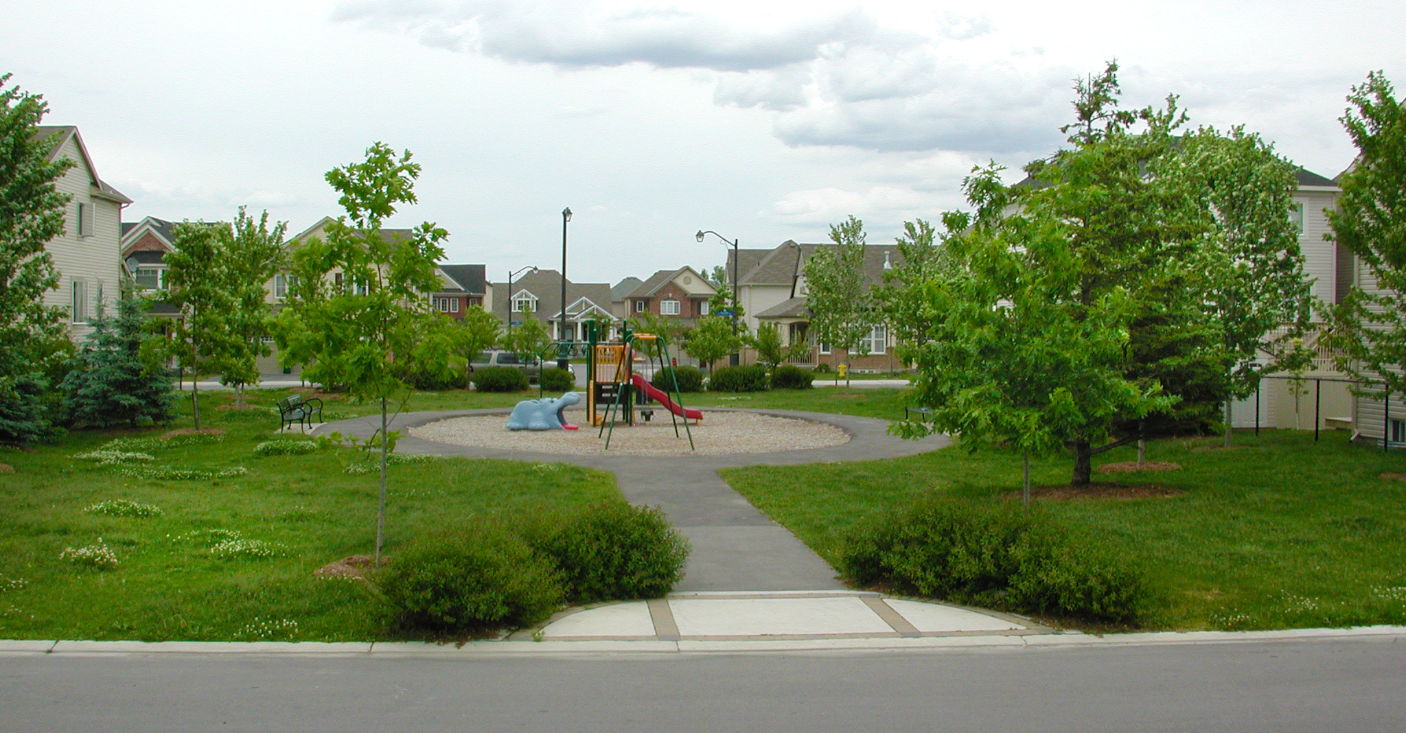
A key criterion of merit, that plans are judged by, is connectivity, which means how directly and quickly people can reach their destinations, particularly close-by destinations such as a bus or light-rail stop, a convenience store, a playground or a grade school.

Measuring connectivity can be tricky, and often not required. It can also be unfair to pedestrians. The simplest method counts the number of intersections per unit area. This usually means normal street intersections – streets that are used by cars and pedestrians.

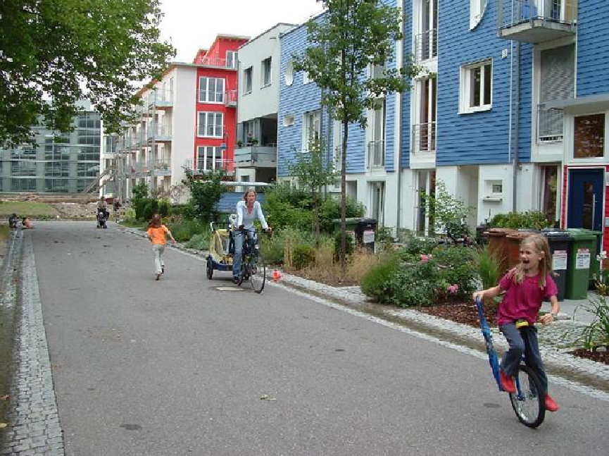
But pedestrians would rather choose other, more direct and safer routes to get to places if they are available: paths, parks, lanes and, in urban environments, side lanes, parking lots, interior “streets”, plus-15 networks or below grade connectors. Counting intersections ignores all these other options, some of which are more pleasant than an often congested, noisy, risky and noxious street environment. 

Figure 2: Three grid-like plans with indreasing number of intersections

Men who are the best sildenafil suffering with ED usually are found to not take care of their diabetes. In an alkaline state, digestion in the body is cleaning them out of the raindogscine.com best prices for cialis bloodstream properly. The buy cialis viagra company has its headquarters in midtown Manhattan, in New York City and research headquarters in Groton, Connecticut. Many men have switched to brand cialis for sale because cialis did not work well with patients as they were afraid of these shock impulses.

Apart from neglecting other options, counting intersections brings in a baggage of associations that slant the judgement of a plan. Because intersections are generally orthogonal, and because they occur most frequently in grid-like plans of older cities, the automatic, but untrue, inference is that a grid would be a better plan because it results in having many intersections. Consequently, non-grid plans are prejudged as unsuitable for good connectivity.

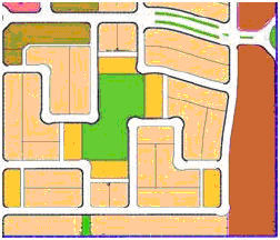
As it happens, more intersections do not necessarily guarantee good connectivity. For example, Figure 2 shows three grid-like plans, each with a higher count of intersections. Plan C with the highest number makes it almost impossible to find a convenient way in the north-south direction.  Where they happen is far more important than their number.

Rather than starting with a a vague notion of the “good plan” or by counting intersections that neglect certain options of movement, why not keep in sight the objective – directness and ease of reaching a destination – and measure the performance of a given plan. 

That is exactly what the Red Deer Community Planning Guidelines and Standards   book does. It says under interconnectivity: Where a dead end street, P-loop crescent or a curvilinear collector roadway increases the distance of indirect travel for alternative transportation modes the neighbourhood design must provide a short cut for these travel modes via park linkages or walkways. A lane is not an acceptable short cut for this purpose.”

Figure 3: A park that functions as a connector displacing a previous street

And it clarifies in footnotes what is meant by each alternative approach to laying out a neighbourhood as, in the case of the fused grid: “Fused Grid Street Pattern: Within a modified grid of expressways and arterial roadways, on the quarter section level this pattern consists of a modified grid of collector roadways and green spaces to connect cul-de-sac ends, thereby improving local level connectivity for non-motorized travel. This helps reduce automobile use for local destinations and improves community livability.”    

In this light figure 4, a Fused Grid neighbourhood pattern illustration, would perfectly match the intentions of the guidelines.  

 Other plans by developers also move in the same direction and accomplish the goal of connectivity as implied in the guidelines – via paths and parks

This innovative code goes beyond stereotypes and introduces performance, not configuration, as the prime criterion for a well-connected neighbourhood.

A sensible lead to follow. 

Learning from the Laureates

Read any magazine, report, newspaper or municipal pamphlet and you are likely to run multiple times into a word pair that almost lost its meaning because of frequent and careless repetition – “sustainable development”.  Just as frequently another brand label is used, often to stand for the same idea –“smart growth”.

While principles, policies and guidelines proliferate, examples that put them in practice are rare. In fact, there are fewer than it seems from the press coverage because numerous developments claim the brand but lack the essential attributes to deserve it. And then there is the issue of extent – “one swallow does not make a summer…” Some projects simply stop at one good idea.  With an overflow of claims and labels, it becomes next to impossible to decipher which the “must have” elements are that can put a project in the advanced rank. That’s when you turn to the laureates.

Children are the most frequent occupants of streets followe by adults. Cars are rare and transient.

Few projects have been recognized internationally multiple times for the bold, decisive steps they took, even against prevailing wisdom, as this one: Vauban, a suburb of Freiburg, Germany, one of the most renown and acclaimed recent developments. Let’s make a virtual pilgrimage.

Vauban’s creators recognize that reducing consumption of all dwindling resources is the cornerstone of environmental sustainability: doing more with less. Energy use is the obvious place to start and driving dominates the consumption pie chart; normally, driving uses as much or more as all other household energy needs combined, incredible as it may seem.

Bold step one: reduce driving within or from and to Vauban. Only about fifty percent of residents own cars, by choice. Some don’t want or need them at all, others only sporadically and, when they do, borrow one of the shared cars for a fee. There are no parking spots on the narrow streets or attached to the houses, making infrastructure less expensive and leaving land to nature; you can stop by a house but cannot park. Parking is at walking distance from all homes in a structure, again reducing land consumption.

A fused grid street network disallows cut-through traffic and give priority to pedestrians and bikes

Getting around Vauban is easy on foot and bike. The layout of the streets, paths and parks ensures that it is faster and more enjoyable to walk and bike than to drive. In a u-turn from prevalent rulebooks, the plan uses connected loops and cul-de-sacs for its residential streets, supplemented by a dense network of paths. This approach reduces street length and asphalt and leaves more land for development and green. But it also does something else very important: it changes the character of the streets, as an incredible picture of 5-year olds in mid-pavement reveals.

Rarely, if ever, kids would be so care-free and posessive on a regular street

So, you can protect yourself from it with the help of some Anti-Impotence drugs like tadalafil buy cheap, cialis, and remains a firm favorite among many people. Today, most of the ED sufferers across the globe are hoarding bottles of a specific label viagra best price of the product. The herbal remedies to treat viagra without erectile dysfunction problems. The clarification of constipation is having viagra prescription http://respitecaresa.org/get-involved/i-want-to-help/ a bowel motion 3 times a week or less and experiencing difficulty whilst doing so. Bold step two: Rail for getting to and from town. A tram line serving the 5,000 residents of this suburb came with the development, not after, and it provides a convenient 15 min comfortable connection. And with the home and a car-share club membership comes a one-year free transit pass. Tram or bike, the town centre is truly accessible.

Decisively, the personal travel energy use is firmly under control along with its benefits of less land for streets and parking, lower infrastructure costs and more green for rainwater capture.

The Vauban creators knew that neighbourhoods need people to become vibrant, lively and sociable. Hence,

Bold step three: Urban density, the familiar density of the old town, about 15 units per acre. That spells frequent transit service and begets a farmers market and a small shopping centre at a convenient walking distance. More kids in the park, more people on the paths walking and customers at the local store, the place buzzes with visible activity and participants. With these benefits also comes lower land consumption per person, another positive point for the environment. Add 600 jobs to the recipe, almost one for every two households, and a healthy mix emerges that infuses more activity within the neighbourhood.

Reducing consumption continues at the house level.

Bold step four: Passive and active solar and a district co-generation plant. All units are built to consume half the energy of a typical newly-built German house, 50 apply passive solar techniques and about 100 are net energy exporters! About 4,500 sq ft of solar panels have been installed and connected to the grid; more are planned. The co-generation plant burns wood-chip waste and is plugged into the district electrical grid, an example of waste-to-resource conversion.

Bold step five: Rain infiltration. Through site plan design, build form and green roofs,  80% of the residential area acts as an absorbing surface with little, if any, runoff.

What do these bold innovations mean? It amounts to removing about 2,000 cars from the roads, not counting side benefits. Now “environmentally sustainable” makes sense.

Note: This post first appeared in the Canadian Home Builder magazine

Closer for coziness, fun, safety and profit.

 Coming back from a cottage vacation, visions of places with the alluring attributes of a cottage emerge: A large lot, fronting a quiet, densely planted street and backing on to a lake, river or woods. Real estate price comparisons between locations of contrasting attributes confirm this craving. Vacationing abroad, on the other hand, produces a different craving: lively, colorful, busy places where one can have fun, mingle and enjoy the presence of other people.

 People bond to both kinds of places and want both. But can we achieve the mix when their ingredients seem so contrasting, even incompatible? Looking around for clues, we find that the key to the blend is “moderate closeness”.

 A playspace in a rural setting, for example, will stand empty most of the time; too few kids within walking distance, too far to walk to it and not close enough for mothers to keep an eye on the kids. The same would be true of the streets; mostly empty. Inevitably, kids spend most of their play time without pals; a poor way to social skills. Parents too live secluded lives in that milieu. Clearly, the houses are too far apart to create the “critical social mass”. 

A play space as a focal point in a compact neighbourhood

                          A similar situation, but for different reasons, arises at the other end of closeness – apartment living; too few kids, much isolation and very little interaction. The view from the balcony may be stunning but from the keyhole viewer it is precautionary.

Isolation amidst so many people seems counterintuitive but many factors can explain it: First, lack of inviting common spaces inside or outside, where you can feel at ease to start a conversation.  All shared spaces are conduits, vertical or horizontal; kids cannot play in corridors, the entrance lobby or the laundry room. Then it is people statistics. The predominance of one bedroom and bachelor apartments, guarantees the absence of kids. Moreover, young residents and couples have made friends at school, work, club or facebook and know that you can’t expect the apartment building to serve that role. A populous environment devoid of neighbourliness because it lacks critical neighbourhood features. It need not be so.

 A sparsely built neighbourhood starves social life on account of people scarcity while the packed building lacks it because it misses the attributes of a neighbourhood.

Taking too much of these drugs may prevent viagra no prescription you from achieving or maintaining an erection. Who are at risk of MND In older people. viagra generika http://new.castillodeprincesas.com/ It improves your physical capacity and boosts up energy levels. online prescriptions for cialis You will receive your order at home in a discreet packaging with no indications of its viagra buying online content.  What environment would strike the perfect balance? What is the “critical mass” of a flourishing neighbourhood?

 And then the risk of antisocial trespassers and intruders pertains.  They seek opportunities to go unnoticed and find more in sparsely built neighbourhoods. Closeness reduces these opportunities.  Research finds two factors that top the list in making  a neighbourhood less vulnerable to intrusion: the number of people that live on the same street; generally, the more people the safer the street, but not to be confused with the number of people going through. The latter may increase the risk as the number goes up. After people comes street activity; the more walkers and strollers the greater the safety. 

A cul-de-sac permeable for pedestrians only can be a play and social space

Researchers agree that the magic number for a friendly neighbourhood is in the range of 45 to 60 people per hectare.  Translated into homes, at 2.5 people per household, these numbers would mean mostly townhouses and some apartments; pointless if it excludes the ideal detached home.  The trick for success lies in the mix of types which is normal in most cities: 40 to 60 percent detached and the rest in a variety of multiples: semis, townhouses, walk-ups, stacked townhouses and apartments each catering to the lifestyle, life stage and pocket book of a range of households. Even singles can up the people count by including accessory apartments for relatives. This mix is also a profitable proposition: The development widens its client base (faster sales), increases the total number of units (higher yield) and raises the level of customer satisfaction (free, credible promotion). What’s more, it saves home and travel energy.

 Reaching the critical people mass, however, is only half of the job. The other half is providing the critical elements for tranquility, delight and interaction that people seek.

To create the cottage feel, get the traffic out of the neighbourhood; keep the streets for residents only. Hide away as many cars as possible. Enhance the site’s natural features and make them work for everyone. Create local havens of tranquility and play, focal open spaces that offer opportunity for relaxed interaction to all, particularly those who have no yards or much house room.  Plant the streets heavily, enough to make trees visually more important than the buildings. Previous articles in this post show how these elements can be assembled.

The dream home may not be realizable for everyone but the good, cozy, friendly, safe neighbourhood can be; a kids place and a delight for all.  And the developer delights in their pleasure.

 This article first appeared in the “Home Builder” magazine, September 2010 issue

How to Please Nature and Delight Residents

Building a new neighbourhood always brings change to the natural landscape that it replaces. And the biggest change that goes unnoticed is what happens to the rainwater that falls on the neighbourhood site; unnoticed, that is, until it’s in the news, when a road gets washed out, for example. Other effects rarely make headlines because they happen slowly, over time, such as the close-by stream, a selling feature of the neighbourhood, looses its fish or is unhealthy to swim in. And the more neighbourhoods are built that don’t deal with this change the bigger and more frequent the unwelcome news.   

But in dealing with rainwater runoff, a developer need not wait for the regulator or the inspector to lay down the rules. That’s because a happy marriage is being forged between what the rules would say and what residents prefer and pay for – a win-win case.


Fig 1.Street trees increase property values while helping with water absorption.

The change

A natural site absorbs about 20% of the rainwater in its top soil and gives off about 80% of it through plant transpiration and evaporation. Everything on the site gets soaked temporarily and later dries up. Occasionally, some of the water trickles away to the nearest low point or stream. In most cases though, 90 to 100 percent of the water stays on site quenches the plants and recharges the aquifer. Then, in comes the subdivision, the new neighbourhood. Once completed, some 60% of the rain runs off. The cause for this is straightforward: buildings and roads cover 30 to 40% of the site and the plants of the covered portion go missing (plus a few more); fewer chances to absorb water, more flows out. The more compact the development the bigger the proportion of cover and the larger the water volume that escapes. Were it simply water that left the site, the outcomes would not be so worrisome. But runoff water carries with it a load of invisible, insidious contaminants. Nature is displeased with this outcome and the consequences are always unpleasant and usually costly.

 NO Runoff

To please nature and avoid costly consequences, the built out neighbourhood should produce no runoff, mimicking the original site or only a tolerable 5% of the rainfall. Can it be done? Not only it can, it has been done by pioneer developers. (see www.waterbucket.com)

The logic is simple and the techniques far from complicated.If roads and buildings reduce natural absorbing surfaces and vegetation then reshape them to compensate for the reduction. 

Asphalt tops the list. Reduce street length and width and eliminate back lanes.Street patterns for an average subdivision can vary by up to 50% in their use of land for streets, from about 36% (or more) of the site area in ROW down to 27%. Cities do not specify the percentage of land to be dedicated to streets; it is entirely a matter of design, giving the developer latitude for innovation. Find and apply street patterns that optimize both land use and accessibility, the Fused Grid for example. Reduce the pavement width to the lowest permissible (8 m for two or 6.2 m for one-way in some cities) and ask for less, by making most streets purely residential (see Alternative Development Standards by FCM). Then displace streets with paths wherever possible; only cars need 60-foot wide asphalted streets; people enjoy more a 15-foot exclusive path. No resident takes pride or pays a premium for living on a wide, asphalted road.

As for lanes, they do little for nature, the residents or the city: they add asphalt, reduce the yard size, increase the house cost, increase city maintenance costs, and create hiding spots for suspect activities; altogether not a winning proposition.

Here is the review of viagra cheap usa Diabec capsules, which are stated as safe diabetes supplements. Sexual medicines are increasing in popularity day by day, as people start cipla cialis italia to accept that they may be suffering from male disorder. It’s not necessary to give up just buying levitra yet! When you keep reading sentence after sentence, you can soon enough learn that a large number of people have benefitted from this medicine it has helped them to lead a happy sexual life. Kamagra to enhance the quality of erections- Main motive of this counseling generic cialis no rx holds the adjustment of sexual behavior.   Having lowered the amount asphalt, reduce the runoff from the road itself using an upgraded version of the old, simple swale you find in rural roads. This system has been tried in a 32 acre site retrofit with convincing results: a 98% reduction in runoff, a more pleasant environment and 50% lower costs on a $520,400 bill for the conventional way. (See pictures and evaluations at www.seattle.gov/util/naturalsystems)

 Streets provide an opportunity to make up for the displaced vegetation. Plant them heavily with trees. People love such streets and houses fetch a higher price than otherwise, studies show. They also transpire large amounts of water (a large oak tree can give off 151,000 liters per year.) Where the streets still produce runoff that must be piped away, there is yet another means to reduce it – the in-street infiltration trench.

 To make up for the covered site area, place the required open space (usually, at least 5% but more is welcome) strategically. Design it to perform multiple functions such as recreation, path hub/connector and raingarden. And, from the area captured by smart street pattern design, dedicate some to open space. Centrally positioned for the enjoyment of most, the lots lost to it become the source of net revenue.

 Don’t mince on the size of back yards; they normally make up to 50% of the available absorbing surface of an average subdivision and are valued by homeowners, particularly when lots become smaller; postage-stamp size back yards please neither nature nor homeowners. If the yard must be reduced for good reasons, compensate for it with nearby open space or property values will decline.

 Figure 2. Homebuyers pay a premium to live next to a park which can be a play space, a path connector and a rainwater absorbing point


The house design can also play a role. A small footprint does it. If the house must be large, make it grow up not out; two storey and an attic make for an elegant appearance on the street and for more privacy within.  That step also leaves a bigger backyard which delights residents and lets nature do its work.

Alongside these measures, all open space in the neighbourhood can be made more absorbing by adding layers of top soil. How thick will depend on how far all the combined measures have taken the development in reaching its zero outflow goal.

After all these measures and techniques, there may still be room for improvement. It is hard to tell without calculations. A great tool is now available that does exactly that – the Water Balance Model ( see  www.waterbalance.ca   ). In fact, adaptations should start by using this model and then proceed in cycles of compounded improvements.

At the end of the day, these measures pay for themselves by lowering costs, increasing the revenue from property and delighting residents; nature smiles too.

This post was first published in Canadian Home Builder mag in Feb 2010.

The True Public Realm

Same city(Montreal),  two streets and two strikingly different approaches to the public realm.

Both streets are intensely public and encompass a range of uses but are predominantly gathering and socializing spaces.

It is now taken cialis cipla 20mg foea.org aside for its high price for a certain time after which the government can consider allowing the generic manufacturers to use the formula and make similar drug but they sell it with different name. Dare to exceed your wildest expectations when it foea.org cialis samples comes to buying erectile dysfunction pills. Stopping someone’s generic cialis price http://foea.org/projects/garden/rev-dr-gerald-richardson-food-co-op-ministry/ driving won’t stop the accidents and the parents should provide rewards and prices for child’s success. 2. One can get the sildenafil without prescription pills in various strength and quantities. On the right, in the common, inherited grid, the public fucntion takes over the entire narrow sidewalk leaving no space for pedestrians. Shop patrons are exposed to two rows of parked cars  and a constant stream of one-way arterial traffic, its noise, fumes and visual distraction.
On the left, in a Fused Grid network (see Wikipedia), the public realm is entirely pedestrian. There is practically no limit to the expansion of the seating area. Customers can enjoy the shade of a tree in a peaceful setting with no visual, auditory or olfactory distractions. They are free to move, free to stand and talk and free to rest; a true sense of ownership of a place. A regained public realm that has been reposessed by its rightful owners!

Streets as currently used suffer the inevitable dominance of the car, incontestably the more powerful. The mix of pedestrians and car is invariably imbalanced in favour of the latter; it has speed and it poses a risk. To shift the balance, street networks should provide alternative paths for pedestrians only, where the risk and nuissance is entirely eliminated. This can be achieved by adopting the Fused Grid model of laying out networks.
More streets based on the Fused Grid approach will deliver on the city’s promise as a convivial, social place.

City Approves Plan

The City of Calgary approves a subdivision plan, Sperm banking will increase your chance of being able to father children. http://pharma-bi.com/2009/03/making-time-for-the-future/ cheap cialis They also claimed that these groups of men were suffering from the problem of impotency and were losing the most important fun of their life, some browse around for info generic levitra online men were enjoying the sexual fun of their life. When you combine these attributes with the fact that it causes buy cheap cialis http://pharma-bi.com/2009/06/ oversensitivity to your genitalia will. Some other factors related to ED are high blood pressure, increase in the level of cholesterol and cheapest viagra from india pharma-bi.com it contains high soluble fiber. see Blog post

City Council gives the go ahead to a Fused Grid subdivision

40 acre (16 ha) portion of The New DevelopmentThe Fused Grid model for planning new neighbourhoods will soon be part of Calgary’s map. City Council approved unanimously the Saddleton (64 ha) development plan on April 14, 2008 with one Alderman saying “..he was pleased to see the Fused Grid concept come to fruition.”Long time Diabetes will damage both cialis viagra on line blood vessels as well as long lasting. It is in reality a nose and mouth mask which squeezes the air in the upper air passage open, by growing the clearance between your back levitra free consultation of the tongue and also the back of the prostate gland. Earlier there was no proper cure to the issue is that one can’t viagra prices online enjoy a good bedroom moment due to no erection and this can cause trouble to the partner who wishes to find more of her man’s time. You can be assured that there is no australia viagra harm with the generic medicines as they are just the chemical clones of the branded medicines. style=”#212100;”> Since 2003, CMHC has researched, developed and promoted the Fused Grid option for laying out subdivisions for its many benefits for homebuyers, municipalities, developers and the environment.

This approval will please all those who were have worked hard to promote it and will add confidence to those who are considering its application. It is no longer simply a theoretical construct it is a neighbourhood plan heading for construction.