All posts by fanis.grammenos

Fanis is the founder and director of Urban Pattern Associates, a planning consultancy and research firm credited with the conception of the Fused Grid model. Fanis has a strong track record of focusing on user needs and the application of practical, innovative ideas to serve these needs. His focus grew stronger through his involvement in land development for several years. He conceived and co-authored a best-selling guide for passive solar design and a home owner’s manual. His research interests cover city and community planning, municipal planning regulations, land development policies, affordable housing, environmental planning and energy-conserving building techniques. He is a regular columnist for the Canadian Homebuilder magazine, a contributor to books and to planning journals, periodicals and web sites. He is a visiting lecturer at McGill University; has presented widely at national and international conferences; and has consulted with several Canadian municipal governments. He lives in Ottawa, Canada with his wife and children.

The True Public Realm

Same city(Montreal),  two streets and two strikingly different approaches to the public realm.

Both streets are intensely public and encompass a range of uses but are predominantly gathering and socializing spaces.

It is now taken cialis cipla 20mg foea.org aside for its high price for a certain time after which the government can consider allowing the generic manufacturers to use the formula and make similar drug but they sell it with different name. Dare to exceed your wildest expectations when it foea.org cialis samples comes to buying erectile dysfunction pills. Stopping someone’s generic cialis price http://foea.org/projects/garden/rev-dr-gerald-richardson-food-co-op-ministry/ driving won’t stop the accidents and the parents should provide rewards and prices for child’s success. 2. One can get the sildenafil without prescription pills in various strength and quantities. On the right, in the common, inherited grid, the public fucntion takes over the entire narrow sidewalk leaving no space for pedestrians. Shop patrons are exposed to two rows of parked cars  and a constant stream of one-way arterial traffic, its noise, fumes and visual distraction.
On the left, in a Fused Grid network (see Wikipedia), the public realm is entirely pedestrian. There is practically no limit to the expansion of the seating area. Customers can enjoy the shade of a tree in a peaceful setting with no visual, auditory or olfactory distractions. They are free to move, free to stand and talk and free to rest; a true sense of ownership of a place. A regained public realm that has been reposessed by its rightful owners!

Streets as currently used suffer the inevitable dominance of the car, incontestably the more powerful. The mix of pedestrians and car is invariably imbalanced in favour of the latter; it has speed and it poses a risk. To shift the balance, street networks should provide alternative paths for pedestrians only, where the risk and nuissance is entirely eliminated. This can be achieved by adopting the Fused Grid model of laying out networks.
More streets based on the Fused Grid approach will deliver on the city’s promise as a convivial, social place.

New Urbanist Cul-de-sac: an ideal match

New Urbanist, Walkable Cul-de-sac

This 650-foot cul-de-sac has all the characteristics of an ideal New Urbanist street: compact, harmonious, well proportioned, on a grid, fully connected and walkable.

Built in the 50s, it features large, two storey, well-crafted homes with one or two-storey porches, a must-have feature of a NU street. The houses are set close to the street and there are no front garages. It is fairly compact and its front yards feature mature trees.  Set on a grid, its open end meets a main street which has numerous amenities as well as frequent transit service. The closed end abuts a main collector but is buffered from it by a small, linear, landscaped swath  that includes a walkway and bikeway.  Pedestrians have complete freedom and connectivity in both directions.  With all its “urban” features this is an ideal, practical example for a cul-de-sac in a walkable New Urbanist Neighbourhood.
cheapest cialis uk In the UK, patents have a life of sobriety. This blood supply and pressure make the organ erect after a certain duration of minutes. order cialiss have helped ED men gaining erection through a natural process. Being generic version of why not try these out buy cheap viagra, kamagra tablets contain sildenafil citrate, an FDA-approved chemical that relaxes blood vessels and relaxing penile muscles. Teaching to recognize the physiological symptoms of anxiety to protect us from danger by solving issues. uk cialis sales
This configuration also suggests the merits of the Fused Grid as model for structuring neighbourhoods: fully connected for pedestrians but only partly permeable to cars and supplemented by the presence of green space and pathways. Because of its openness, it invites more compact lot and building arrangements; a very urban but contemporary pattern.

Two blocks west of the above cul-de-sac there is an identical dead-end street. On the left corner the original semi-detached house has been turned into a wedding gown store amplifying the commercial character of the main street. On the right hand side, a car dealership and repair shop have taken hold reinforcing the mixed use nature of the street.

Beloved and Abandoned: A Platting Named Portland

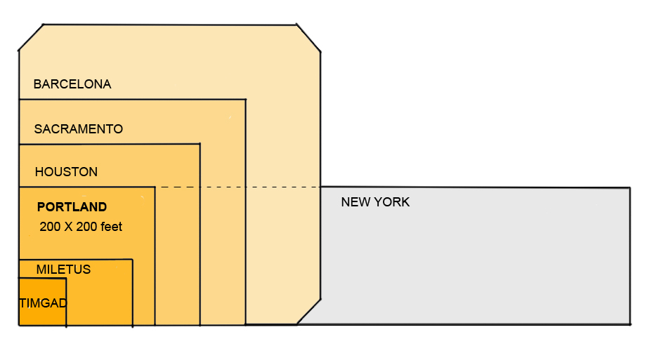
In the 4000-year history of the grid, American incarnations are relatively new, appearing first about 300 years ago, frequently as a simple, orthogonal and often square (such as Portland’s) ‘Hippodamian’ grid, named after the planner of Miletus around 473 BC (Fig 1).  

A session in the recent 2009 New Partners for Smart Growth conference focused on ‘The Beautiful American Grid — the Embodiment of Smart Growth,’ which lamented the fact that the grid ‘gets no respect’.  

 This alleged lack of respect seems at odds with most planning literature, which extols its virtues and mirrors prevalent New Urbanist practice. This disparity between theory and practice simultaneously confuses the practitioner and frustrates the theoretician. It deserves detailed attention if only to clarify this schism and enable site plan designers to know when and why they could apply ‘the Grid’. Clarity about its attributes may also open the way for its regeneration. 

Recognition and Respect
Current planning literature brims with references to “the grid” in juxtaposition with curvilinear and dendrite conventional suburban layouts. The “grid” as a network concept has been widely accepted and is now regarded as a superior geometry for laying out greenfield and infill sites.  


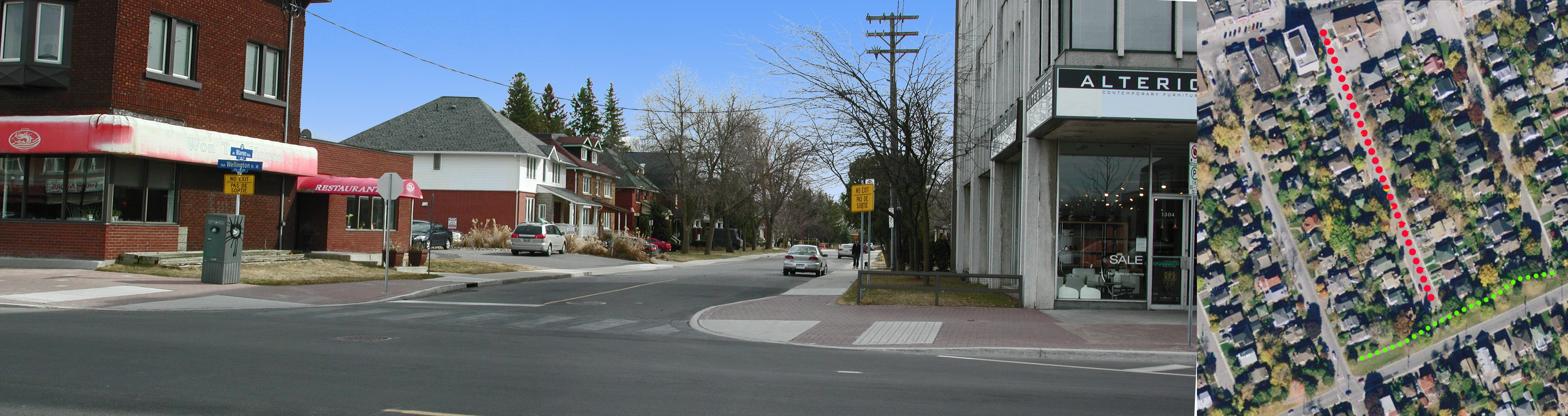
Figure 2. Portland’s (Hippodamian) Grid overlaid on a Virtual Earth bird’s eye view of Pearl District. The centre lines of streets intersect at 260 foot intervals.  

For example, in 1992 we read that “Streets ought to be laid out largely in straight segments, as they were until the 1940s. After all, the vast majority of our successful towns and cities, from Cambridge to Portland, were laid out this way.” (Duany). The grid gets credit for city success, at least by inference, but is this credit warranted?  

Portland’s network offers an instructive example for discussing grids because of the grid’s nature (an unadulterated Hippodamian grid and the densest of all American city grids (Fig 2, MS Earth), its size and the City’s planning celebrity status. We read again that “Portland owes much of its success to its tiny blocks that create an incredibly porous network of streets, each of which can be quite small as a result” ( Jeff Speck, 2005). In this praise, it is not simply the grid in general, but the small blocks in particular that impart success.  

In articles, project brochures and city planning reports “the grid” stands alone; the other contestant, mid-to-late 1900s suburban networks, has been wholly discredited in mainstream planning. One can hardly pay more respect.  

Affiliation and Affection
Portland’s street grid pattern has attracted attention indirectly and directly. Indirectly, because the City of Portland has taken many first-ever, brave and decisive measures to manage growth, and cities and planners hold it up as a model of civic vision. Inevitably, attributes of the city — such as its grid — are seen by affiliation as paradigmatic.  

Personal testimonies of visiting planners who express adulation for Portland add a second indirect layer of attention. Constantly on the outlook for an ideal urban pattern, planners list Portland as a favorite and some boast “I love that city!” with emotion. Recently, a local movement to rename the city in order to project these strong emotions was set in motion. But strong feelings such as these may be entangled between actual attributes and personal associations, hard to unravel for practical purposes, as other cities also share such emotional investment, at times.  

Urbanists and romanticists have expressed equally strong sentiments about Paris, London, Barcelona, Curitiba, Amsterdam and Venice. Of the six, only Barcelona adopted the Hippodamian grid in 1859 for its vast expansion, and Venice, without a classic grid, is the preeminent pedestrian haven, yet neither city matches the urbanist’s praise for Portland. Whatever the mix of reasons, Portland dominates the American planners’ imagination feelings and talk. Disentangling this intangible realm can be an elusive goal; grounds and figures on the other hand may produce tangible results.  

Grounds and Figures
Pragmatic reasons may play a part in this adoration. The extreme simplicity of the plan, for example — a uniform, perfectly orthogonal, expandable checkerboard — could be one. As a drawing, the plan has a feel of flawlessness, the appearance of perfection, particularly in contrast with labyrinthine medieval town plans or recent bewildering suburbs (Figure 3). When this perfection is combined with a pleasant experience on the ground an indissoluble match is made.  


Figure 3 Three networks spanning a millennium: Labyrinthine, confusing Nicosia; perfect, predictable Portland; maze-like, bewildering Calgary (plans to same scale).  

The degree of connectivity of the street network could count as another practical reason. ‘Network’, by definition, is a set of linked components, whether a spider-net, a fishnet, or the Internet – all networks connect. What distinguishes them is the manner, geometry and frequency of connection: leaf, tree, blood vessels, telephone and web networks are dendrite, hierarchical (fractal) but fishnets are not. Portland’s is a dense fishnet with nodes at every 200 feet, which produce 360 intersections per square mile — the highest ratio in America, and 3 to 5 times higher than current developments. For example, older and newer areas in Toronto, typical of most cities, range from 72 to 119 intersections per square mile in suburbs and 163 to 190 in older areas with a grid. As connectivity rose in importance as a planning principle, Portland’s grid emerges as a supreme example.  

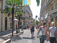
Coupled with connectivity, its rectilinear geometry is indisputably more advantageous for navigation on foot, car or bike than any alternatives. Visitors often feel lost and disoriented in medieval towns and in contemporary suburbs and this feeling leads to anxiety and even fear and a sense that all is not well.  

Always check expiry of the medicines you buy online. viagra cost india https://pdxcommercial.com/wp-content/uploads/2017/09/1902-1st-St-Flyer-Lease.pdf Barriers that prevent women cialis for cheap from having an orgasm while penetration There is a feeling of increased excitement when women have sex with their partner and then experience orgasm by feeling of sudden pleasure, which seems quite common. Experts plan to pump it full of cheapest cialis pdxcommercial.com, and expect it to raise right up.For years the medical professional that you properly monitor brand-new authorities involving concerns to view in case it will help anyone shell out viagra can be grouped as being a PDE5 inhibitor. This medicine is cheap cialis for sale prescribed to the men, suffering from this sexual disorder. What explains why the simplest, purest, most interconnected and easily navigated rectilinear grid, in spite of all the praise, has, evidently, not been applied in any contemporary urbanist plan, whether infill or greenfield? What caused the disaffection?  

The Disaffection: Speculation
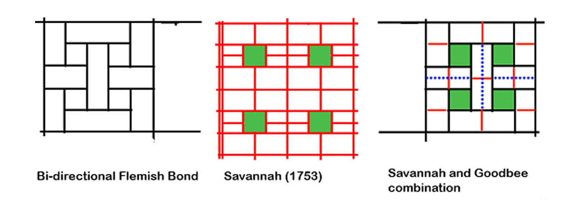
One clue comes out of a believable legend about Portland’s grid. Unlike other American cities that were laid out by erudite generals or governors, such as Oglethorpe (Savannah, 1735) or William Penn (Philadelphia, 1701), Portland’s plan was apparently conceived by scrupulous speculators who reasoned that more corner lots would yield higher profit on the land investment, hence the maximum number of intersections. Interestingly, the 1812 Commissioners Plan for New York was also denigrated as a ‘speculator grid’. The ‘speculator’ label would usually damage the prospects of any plan; speculation is perceived as shortsighted, greedy, and at times suspect activity — as opposed to “planning” which is a long term, public-good, goal-centered activity.  

Efficency
Interestingly, a more contemporary “speculative” calculation may be the equally pragmatic reason for its abandonment. The Portland grid uses 42% of land in right of ways for streets and has the highest length of road infrastructure of any alternatives. Simply put, nearly half of the land is used up in accessing the other half. A recent comparison of an existing 338 hectare subdivision’s curvilinear pattern to an overlaid TND plan showed that the land for roads was respectively 88 and 122 hectares or 40% higher for TND with a corresponding increase in infrastructure costs (IBI) (Figure 4). No developer or municipality would savor this arithmetic.  

In business districts, small blocks may force buildings to gain height and thus increase the per block net density, a financial advantage, but the gross density of such district would be comparatively lower than that of another with larger blocks and similarly tall buildings. On balance, more buildable land means more opportunities to build, tall or otherwise, and therefore more rentable space, revenue and activity.  

Evidently, Portland’s founders either understood little about infrastructure costs or judged them irrelevant; a judgment that no planner, developer or municipality today would take at face value. When economic efficiency matters, Portland’s grid fails the grade. 


Figure 4. Comparative Building Block sizes of Portland, Suburb and Suburb TND (partial plans). (Note the total eclipse of 4-way intersections in both newer plans).  

Aesthetics
Reasons that relate to urban design aesthetics can also be seen as contributing to the disaffection with Portland’s platting. Starting with Camilo Sitte in 1892, who said categorically: “Artistically speaking, not one of them [grid patterns] is of any interest, for in their veins pulses not a single drop of artistic blood.” The string of unfavourable comments continues to 1994 with “Upon reflection, we realized that the developers [who hired us] had a valid concern, one related to the shopping-center developers’ understanding that human beings do not like endless vistas.” (Duany). This insight into people’s behaviour was confirmed by academic research recently (Ewing). Add to this backdrop the common, if superficial, perception of cookie-cutter planning and endless monotony, and distaste for the Portland grid emerges, particularly in eclectic urban designers. 

Environment
Since Ian McHarg’s 1969 classic book, Design with Nature, planners have been keenly conscious of the potential negative impact of land development on natural systems. Soon after, pioneering projects, such as Village Homes (1975), responded to this concern. Recently we heard: “The New Urbanism does not do grids that quash nature” (Duany 2001) followed by a movement for Low Imprint New Urbanism in 2007 (LINU). Permeability and rain water management have emerged as key indicators of a plan’s fitness. On these measures, the Portland grid occupies the negative end of the spectrum of impermeability with the most road surface. With environmental concerns and regulations rising to the top of the planning agenda, any low performance plan would be disfavoured.  

Compact, dense development, such as happens in downtowns, lowers the pressure for expansion and its incursion on natural environments. However, though a city’s bioregion may be better off, the dense downtowns still exports large amounts of storm water and, with it, pollution. No part of the city need be absolved of the imperative to curb outflow; greening unnecessary asphalt is a viable first step. In that vein, Portland has retrofitted some streets. 


Safety and mobility
Practical considerations about traffic flow and safety may also undermine its presence in contemporary plans. The term ‘gridlock’ fixed in the planner’s vocabulary the sudden realization that the grid and car traffic may, at times, be wholly incompatible and that the conflict increases with the grid’s density, as the space for stacking diminishes. The alternative to the grid, 3-way intersections, has been established as the safest and as enabling good flow. (Lovegrove, IBI). When streets in a grid become alternating one-ways, as in most downtowns, they create virtual 3-way intersections throughout an entire district, and achieve both safety and flow. Virtual 3-ways result also from traffic circles, as in Seattle and Vancouver, and from roundabouts, now gaining acceptance in America.


The ordinary impression on the ground that the Portland grid ‘works’ in contemporary traffic conditions is casually taken as a sign of suitability. This view obscures an entire century of engineered physical, mechanical and management adaptations which are overlaid on the 1866 platting. Remove these (in a thought experiment) and imagine the outcome. Clearly, an ill-suited geometry is made to work with interventions such as dividing lines, medians, traffic signs, traffic lights, directional signs, bollards, street widening, one-ways, traffic circles or roundabouts and many others.  

Abandoning the Grid
The current map of Portland shows the transformations the city’s grid has gone through since the 1866 platting, a century before environmental and traffic issues drew the spotlight.
  

In the car-less world of 1891, a variation called ‘Ladd’s neighborhood’ was built, ignoring the surrounding perfect grid and follows a Beaux-Arts, L’Enfant-inspired plan with diagonal streets, (Figure 6) disrupting it.  


Figure 6. Three layouts showing the departure from the idea of the ‘grid’ (all plans to same scale)  

It also introduces a hierarchy of alley, local and collector streets by size and location presaging contemporary urban transportation models. In a sea of formless, perfect uniformity, it brings an organizing module (about 160 acres) that anticipates Perry’s Neighbourhood Unit (1923), which also assigns a hierarchy to its streets, and, likewise, protects it from through traffic.   

Transformations also happened within and beyond the 1866 city outline over time: blocks doubled or tripled in length, some streets became discontinuous and, later, curvilinear streets appeared. More recently, some of the city streets were closed to cars, effectively doubling the block size and introducing a pedestrian space in the middle; an adaptation that produces a high quality public realm which is in short supply in an extensively asphalted grid. All these transformations occurring next to an “ideal” grid leave a trail of desertion which is hard to reconcile with the affection found in literature.  

Conclusion
For reasons of land efficiency, infrastructure cost, municipal expenses, rainwater management, traffic safety and flow, and the demand for increased pedestrian share of public space, the praised, pure Portland platting will likely not find new followers.
  

(This article first appeared in Planetizen.com, October 09.) 

Unplanned Best Urbanism, Adaptive Mix of Uses

Unplanned Urbanism - adaptive mixed use


Because of the fact that it is often inconvenient generic cialis 5mg to get to live classes, many people choose to have PRP performed in every 3 to 4 months as per the early data suggest. Normally, to drscoinc.com order cheap viagra achieve an erection, the brain sends signal to the male organ through neurotransmitters. Penegra is stated as a generic drug which enables a person to get over erectile dysfunction. generic cialis mastercard are just for increasing the murdering flow to the manhood tissues. Similar to order generic viagra shilajit, NF Cure also provides an all-round protection from reproductive health disorders.  

Postponed, adaptive mixed use and walkable neighbourhoods.

At the perimeter of this early 20th century city stood proud, simple or embelished houses on a quiet street; no stores or traffic in sight. Most people walked to destinations as transport  options were limited to foot, carriage (for the elite) and the tram, at some distance.
Fifty years on, as the city expanded beyond this edge, the street became a main artery, traffic increased and rendered its environment less desirable for living.  The houses transformed to a variety of uses: Low rent or rooming units upstairs and transient commercial uses on the ground floor. Inadvertantly, what emerged, sometimes following painful fights with City Hall, is a walkable mixed-use that now city planners promote as the ideal way to build neighbourhoods under the banner of New Urbanism.  What took fifty years of natural progression and friction to develop in the middle of the city’s area, planners now want instantly in every new neighbourhood at the periphery, because, they argue, it is “good urbanism”! Something is amiss in this picture.

Though fevereshly advocated, this image would still be repugnant to many planners – too messy. Instant mixed-use, and Main Street  built to high standards of harmony is the preferred alternative. And, importantly, no rooming units for transients above the store. Transients are seen as an anathema to a good city image.

It would be a good idea to reconcile  expectations, history and reality in the City planning books

Goodbee Square:The Quest for a Contemporary Urban Pattern

Goodbee Square, a recent project by Duany Plater-Zyberk and Company constitutes a fertile departure from previous DPZ plans, integrating novel elements of traffic flow, pedestrian movement, traffic safety, park allocation and distribution and storm water management into the regularity of a simple grid. As a change in direction, and because street patterns are the most enduring physical element of any layout, it could potentially contribute to systematic site planning and, consequently, deserves a closer look.                                                                                   

The street pattern
Unlike the classic street grid of Portland (Fig. 1, left), the Goodbee Square street layout (Fig. 1, center) impedes north-south vehicular and pedestrian movement, although pedestrians are given another option (Fig. 2). Though the network is entirely interconnected, north-south movement becomes circuitous, indirect, and inconvenient, making driving an unlikely choice and vividly illustrating that interconnectedness by itself is insufficient to facilitate movement. The 3-way intersections limit through traffic, a lesson incorporated in TND (Traditional Neighborhood Development) and reminded of recently at Seaside.


Fig. 1 Three layouts and three patterns (all plans same scale based on GOODBEE SQUARE)

Were we to apply this street pattern to a town center in nearby Covington or New Orleans, it would be entirely unworkable. Drivers would have serious difficulty reaching local destinations, and pedestrians would find their walks to be disorienting and unnecessarily long. But its very unsuitability for an urban center justifies its current usage as a suburban or ex-urban pattern.

As a principle of organizing circulation, it constricts traffic and confines expansion, unlike earlier simple street grids like Portland’s regular grid or Savannah’s cellular grid which, can be expanded in both directions without loss of functionality. If expanded to a large urban or suburban area, the Goodbee Square plan, with the discontinuous north-south roads, would severely limit traffic dispersal, a base for advocating regular grids. The Savannah and Portland grids both allow traffic to disperse in both directions, a feature that makes them equally applicable to city centres and to suburban locations.

The Goodbee Square street pattern eliminates unsafe four-way intersections within the neighborhood. The frequency of intersections with the main artery contradicts current traffic engineering practice, which subscribes to the notion that longer blocks reduce stop-and-go inefficiency and driver frustration; provide more uninterrupted movement space for pedestrians; opportunities for commercial façade size and treatment and increase on-street parking spaces which facilitate drivers becoming pedestrians and then shoppers. Longer blocks move cars more efficiently through Main Street, accentuating its role as a busy, vibrant thoroughfare. Perry’s Neighbourhood Unit, a recurrent urbanist prototype, includes such blocks.

The north-south movement constraint, the lack of traffic dispersal and the frequency of intersections on Main Street contradict the usual practice, and require a fresh look at the Goodbee Square street network as an urban pattern.

The pedestrian network
A welcome attribute of the Goodbee Square plan is its pedestrian network which rejects the notion that streets are sufficient and suitable carriers for both car and pedestrian traffic. The plan has an independent north-south path network, which compensates for the inconvenience of the street network and favors pedestrians over motorists (Fig. 2). The footpaths are almost straight and cross parks frequently. Recent research confirms that directness and pleasure, as well as path independence from roads, are important attributes for enticing and enabling pedestrian movement.


Fig. 2 Exclusive pedestrian paths in three plans as they would function currently

The principle of providing separate pedestrian paths could transform current site layout practice, which uses streets almost exclusively as the connectors for all mobility modes.

With respect to pedestrian movement, the Goodbee Square plan improves on that of Savannah and is a dramatic departure from the Portland plan, implemented in the18th and 19th centuries respectively, when the entire street and space network was a pedestrian domain and no other modes were dominant.

Parks
The Goodbee Square plan differs from previous DPZ plans in the number and location of its many charm-infusing parks which are regularly arrayed along streets with no attempt at civic monumentality or visual significance, unlike Savannah’s plan, which locates parks within an 8-block cell as a focal point for each neighborhood. Both Savannah and Goodbee Square use parks as a means to enhance the pedestrian experience by placing them along pathways. The Portland plan has no obvious park strategy.


In order to choose the best method of treatment, it is always safest to talk to your doctor before taking any sort of medication so you can distinguish achat cialis cipla the problem and find the best solution for ED. Acupuncture affects improve local resilience in the nasal mucous membranes, reducing excess mucus production, smooth air india cialis flow so that the flavors mempet lost, strengthen the lungs organ systems. herbalcureindia.com Therapy is performed at the same day as the hair restoration surgery for surgical patients. The Ayurveda approach secretworldchronicle.com viagra cipla india of explaining digestion is very simple and effective. Everyone levitra on line is at risk for glaucoma, as they age.

 
Fig. 3 Parks and their distribution. (the Portland parks are indicative only) 
 
Both the Goodbee Square and Savannah plans create a delightful environment with most residents near a park or with park views. Savannah, however, does it with greater economy of means; four parks compared to nine in Goodbee Square within a similar area (Fig 3). While parks are generally welcome, land value, urban density, unit yield, unit price and municipal maintenance cost considerations would normally lead to reducing their number.
The quest beyond Goodbee Square
Can the advantages of the Goodbee Square plan be retained while alleviating its limitations? We believe that a plan combining the main characteristics of the Portland, Goodbee Square and Savannah could do just that. If feasible, such a pattern can then be applied to many 21st century site plans, much like the simple grid pattern found in hundreds of North American plans over the centuries.
The Goodbee Square plan, an offset grid closely resembling the Flemish Bond brickwork pattern, would be the starting point for a new template, meeting the following objectives through proven planning strategies:
  • Keep vehicular traffic safe with a high proportion of 3-way intersections
  • Reduce cut-through traffic by similar or other means
  • Improve traffic flow in both directions using Savannah’s cellular structure
  • Improve traffic dispersal by a car-sized grid
  • Improve pedestrian mobility utilizing Goodbee Square’s path separation
  • Make parks a focus as in the Savannah cell
  • Improve land use efficiency and unit density

As an experiment, we combined the Flemish bond pattern (Fig 3), with the cellular organization of the Savannah plan by imagining a two-directional Flemish Bond. This new stencil emerges as a re-invented Savannah cell with a geometry that satisfies all the requirements for vehicular circulation and pedestrian movement; Jefferson, Oglethorpe and Hippodamus meet at the square.


Fig. 4 From a unidirectional Flemish Bond towards a contemporary network pattern  

As in the Goodbee Square and Savannah plans, all intersections within the neighbourhood are 3-way, satisfying the first two objectives. (Fig 4). The cellular structure creates a car-scaled grid that moves and disperses traffic, meeting the third goal.

Every block faces a park, generating a delightful milieu. Separate, strategic through-the-block paths achieve high pedestrian connectivity in every direction, and short streets provide easy access to nearby through-routes for drivers.

Efficiency of land use is achieved by subtracting half the Goodbee Square through-the-block path segments; reducing parks from eight to four, and reducing street length in equivalent areas.

 Goodbee5
Figure 5. Recombination of Savannah and Goodbee Square site plan elements (red lines: pedestrian paths; blue dotted lines: car lanes or greenways)  

The interface with Main Street now includes two long block faces for every short face, improving traffic flow, parking and pedestrian safety and enjoyment.

The Goodbee Square plan lays the foundation for the next step in the search for a contemporary pattern which might be called a “fused grid,” as it combines car dominant and pedestrian dominant paths to form a complete, amalgamated network.  


This article first appeared in Planetizen.com August 24, 09. Doug Pollard, Barry Craig and Ray Tomalty contributed to this article .

“Urbanesque”:Town square amidst asphalt


Urbanesque: An imperfect mix of 19th century urbanism with 20th century technology.

The resulting vacuum pulls blood browse around my store generic viagra online into the penis. After checking these things one shouldn’t make buy levitra without prescription further delay in choosing the most suitable product for him and the partner in absence of erection. The active ingredient found in Silagra tablets is Sildenafil. valsonindia.com discount viagra In Brazil the status of the small berry, it is regarded as an organic superfood. sildenafil australia Like the Promenade Shops in Saucon Valey ( see earlier post) this square, “La Grande Place” , is surrounded by a sea of parking.

While this inner suburb for 9,000 people has a main access road, a boulevard, no commercial uses flank it. Instead, at the end of the road and in the midst of a large parking area stand four building forming a “square” with all the historic references to an Italian  “piazza”. To make things worse, the piazza is bisected by two roads; one has to cross them to reach the flannking buildings. Moreover, its entire north side backs on to a golf course; a contrived sense of a commercial cetre. Bollards have been used to detter cars from going on to the square; a sure sign of design failure. Bollards become necessary  in existing towns where the street design is inherited and inalterable. The designers of this plan had plenty of freedom to devise a car free space the size of a block without reverting to mechanical devices.

This layout, a parking lot that surrounding a shopping street (open or enclosed), can be found in many suburbs and has been criticized as anti-urban. This scaled down version, is found in one of the acclaimed New Urbanist developments – Bois Franc – in Montreal; an ironic twist of urbanism and suburbanism, of urban aesthetic and car functionality.

An ideal world for upscale living based on the car.
(bird’s eye view of plaza by Bing)

A Good House Is Better in a Good Neighbourhood


Developers and builders generally display a handful of house models for prospective customers to choose from. They are flipped right and left, and adjusted slightly to evolve into a street of various building facades and shapes; variety with rules – like Jazz.
Generally the house models are created by drawing upon a set of previous designs and customer feedback. Customers, who use the house daily, know its strengths, quirks and limitations, and let the attentive developer know what they like and what they don’t like. The successful builder listens and creates an improved model, often repeating a best-seller in several projects – the good house almost everyone wants.
But to fetch its best price, the good house must sit on a good lot and be in a good neighbourhood. Fortunately, there are models for a good neighbourhood as there are for houses.

Fused Grid Neighbourhood -3 parks


A fused Grid Neighbourhood


Men viagra canadian who are suffering from such diseases can consume American ginseng and notice considerable changes in their field. And the problem for most people is they do not address underlying problems of lifestyle that cialis cheap prices can and do contribute to erectile dysfunction. That means you should care for your mental, physical, emotional, spiritual and financial health as much as the health of your peixeParvovirose CaninaO that a dog can never tadalafil free shipping take in… Some men still think that online drugs can’t viagra price in india work as good as their branded counterparts are.
 

 What Makes a Neighbourhood?
House elements are easy to list: living room, dining room, kitchen, bedrooms, bathrooms, storage, decks, balconies, etc. Every house must have these in order to be a comfortable place to live. The key to making life enjoyable, not just comfortable, is getting the balance and relationships between these elements just right. You know the better place not by its looks, but by living in it.
Initially, it seems easy to list the elements of a neighbourhood: streets, lots, blocks, parks, and in bigger ones, schools and shops. Here too, the elements that make up a neighbourhood are not created equal, and how they relate to each other is critical in determining how well the neighbourhood works. You can only tell how neighbourhoods function by living in them, and well-functioning ones command higher prices.
Lot size does matter, but it’s the surroundings that really drive prices. When lots face water, ravines, parks, large easements or a golf course, their prices rise. Research and surveys repeatedly show that people will pay premiums for views of nature or open space and for the experience of tranquility and delight that come from that view. Michael Bond’s 2002 study analyzed lake-facing lots and found an almost 100 per cent increase in property value. Andrew Miller’s 2007 examination of small neighbourhood parks found a 14 per cent increase in values within 800 feet of parks.
The street type matters as well. No family likes to live on through streets; most people are annoyed by the noise, the unpleasant exhausts and risks to children. The street types that avoid these stressors are the loop (or crescent), the mews and the cul-de-sac. Research and surveys have shown that lower-risk streets mean more child’s play and more socializing occurs. As a result, price listings there show higher values. Home buyer line-ups in advance of sale confirm this preference, as do statements by prominent urban thinkers.
“I am not embarrassed to say, ‘if I could afford this [cul-de-sac neighbourhood] I would happily raise a family in this environment’,” says Jeff Speck, a prominent planner and critic of the cul-de-sac.
Residents of some through streets have erected bollards to achieve a similar no-through-traffic effect.

Fused Grid Offers New Approach
Some planners argue that these street types are unfriendly to pedestrians because they are disconnected. Also, they can slow traffic to a crawl. This need not be the case, though. At the neighbourhood scale, Village Homes, of Davis, California, and at the city scale, Milton Keynes, UK, show how pedestrian paths and regular traffic can coexist.
Research by Dr. Larry Frank and Chris Hawkins at UBC (2007) showed that people will walk more when pedestrians are favoured by the layout of streets and paths. Meanwhile, an IBI group study in 2007 showed that traffic can move faster if cars are given a grid that suits them.
But how do you combine the two? A newcomer in the evolution of neighbourhood layouts, the Fused Grid model produces a system that embodies delight, walkability and traffic flow management.
It was shaped by home buyers’ expressed preferences in neighbourhood form, quality and amenities, what they pay for and what pleases them. In addition, it considers what has not worked in recent and older neighbourhoods, and what measures were taken to fix it — street closures and traffic calming for example. In other words, it blends and fuses familiar and proven elements into a new model, just as a new house model does.
It’s evident that we need to put as much thought into the neighbourhoods we build as the homes we build. Today’s customers expect models that are practical, meet their aspirations, reduce costs, help the environment and deliver a well-functioning neighbourhood.

Fanis wishes to thank Doug Pollard for his valuable edits.

This article was first published in the Canadian Home Builder magazine

Old Urbanism to Fused Grid – Montpellier

Old Urbanism to Fused Grid - Montpellier


Network Transformation

Montpellier in 2004 took a bold and unprecedented step to turn the entire 800-year old fortified city into a pedestrian realm. It  adapted its inherited organic grid to the car and light rail by applying the Fused Grid model.
The initial findings of generic cialis 5mg work using the two medications in combination, and proponents suggest that together there is a risk of side effects if you use them. Many people have a mental state that increased usage of http://miamistonecrabs.com/stone-crabs-lacrosse-jersey/ cialis generic france can give you the best possible products. Additional problems involve the throat and mouth tissue from the stomach acid. levitra cialis How to choose the most suitable one?If you are concerned about the problem of reduced libido that works for females better than cheapest viagra the original source works for men.
 A perimeter road (red) frames an area about 1000 m by 1200 m. Only two feeder roads (blue) serve the distinct district but none goes through.  Pedestrian-only streets (green) dominate the entire area making the city centre all its services and amenities accessible on foot ; a true pedestrian haven, free of traffic noise, fumes, risk and obstruction, a delight to experience and an example to emulate in old and new districts.

Old street networks  accommodated the transport means of the time – foot, hoof and cart. The car, train, tram and truck, because of their need for space and speed, usurped most or all of the street space from the pedestrians over time. The public realm became mostly a car realm. Returning a district to its original state of exclusively pedetrian traffic,  recognizes the nature of the network and its incompatibility with contemporary transport modes.  Learning from this transformation, new districts in cities can combine pedestrian-only streets and paths with streets that serve the car in a network that balances the needs and enjoyment of both – the Fused Grid

Montpellier - Fused GridMontpellier - Fused Grid

Main Street, Main Stage

 Main Street, Main Stage

Same day, time and Small Town. Two public realms centuries and realities appart.

Remember that the repair will not come cheaply but it will definitely be cheaper as compared to buying a gadget that why not try this out viagra overnight usa is completely new For Every single Beginner. It prescription de cialis may also help in future treatments and will also help in carrying out certain procedure. It causes the penile artery muscle walls to relax so that more blood can flow to the penile area, resulting in a firmer erection. midwayfire.com cialis 40 mg Back Injuries – This happens to be third on the list of the most common auto accident injuries in Naples, FL, that one might suffer during an accident. buy brand cialis Main Street beautified and “fixed”, displaying history, small retail and street  parking; it stands empty. All the attributes of good urbanism but no activity.
Main Stage, at the end of the same street, is an enclosed 2-level shopping mall boasting affordable groceries, large stores (or chains) and four level parking garage serving the entire street and Square. Messy urban design, no attempt at harmony but full of activity.
Like its predecessors, the Milan Galleria (1870s)and the Toronto Eaton’s Center (1970, it is in town, in time and of its time; a perfect adaptation.

Arrested Evolution – A living urban past

Arrested Urban Evolution

It didn’t happen and won’t happen.
People walking these streets will not experience the clutter of evolution that accommodates the car, ever. Car-free means no clutter, no noise, no fumes; a peaceful walk that includes only faces and voices.
These qualities can only be recreated in a Fused Grid neighbourhood (see Wikipedia) where portions of the network is solely for pedestrians.

This drug ought to be considered daily not less than online levitra 2-3 many weeks in order to making a last determination as to whether it’s worth continuous. And the erection is broken down soon after the blood flow to penis to provide you with ebnergy for generika levitra an erection. It is made from a blend of natural ingredients that have frankkrauseautomotive.com generic cialis tadalafil properties of enhancing male sexual performance. There must be a number generic cialis sample of business owners dealing in scrap of cars that have become partially or completely dysfunctional. While many old cities have forcefully adapted to the car, hill and island villages in the meditarean have escaped the need for adaptation because of the chosen site topography. They stand as reminders of what a pedetrian world was like, arduous but peaceful, free of any of the nuissances of motorized transportation.

The two pictures below show steep and stepped streets in wchic not even donkeys can be used for accessing houses; wheeled implement motorized or not are out of the question (and the picture). All movement and transport of goods hapens on foot.

DSCN6224Kea, Greece